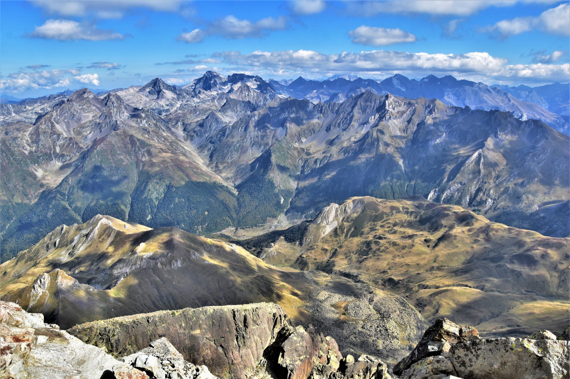

From now on I will put forward a new topic: taking you up Ireland’s iconic mountains. Those which can be seen from far away, those which steep slopes make your eyes open wide, which summit vista is as beautiful as a dream, yet which name sometimes sends shivers down your spine while thinking of their huge size and how hostile they can be under bad weather. The changeable, unpredictable weather conditions combined with the usually hard-going terrain indeed turn these hills into mountains. Despite their modest height and the rather reasonable amount of ascent implied, the Irish mountains are tough for the novice. But when it clears out, even just a bit, it is pure magic…
I will start this series with one of my top favourite summits: Muckish, in the N of county Donegal. It may not be the first Irish mountain which I climbed, but Muckish has marked the beginning of my peak-bagging adventure in Ireland, to tackle the 570 Irish +500m summits -i.e. those which can reasonably claim the status of “mountains”. Inspired by my first expeditions in the mountains of Connemara in 2005 and the ascent of the highest Irish mountain, Carrauntoohill (1038m) in 2006, I decided to fly back to Ireland in November 2012 and start this impossible quest. My first summit would be Muckish (667m).

The ascent from Muckish Gap (ca. 240m) is steep but the total ascent is far from being substantial. A tough job though. The route is pathless and there is still a bit of snow above the 500m contour, but most of all the bitterly cold wind and my lack of fitness at the time made the ascent all the more difficult. And with the clouds settled on the summit plateau, navigation happened to be quite tricky. That day, I realised there was a lot of work ahead to achieve my goal…

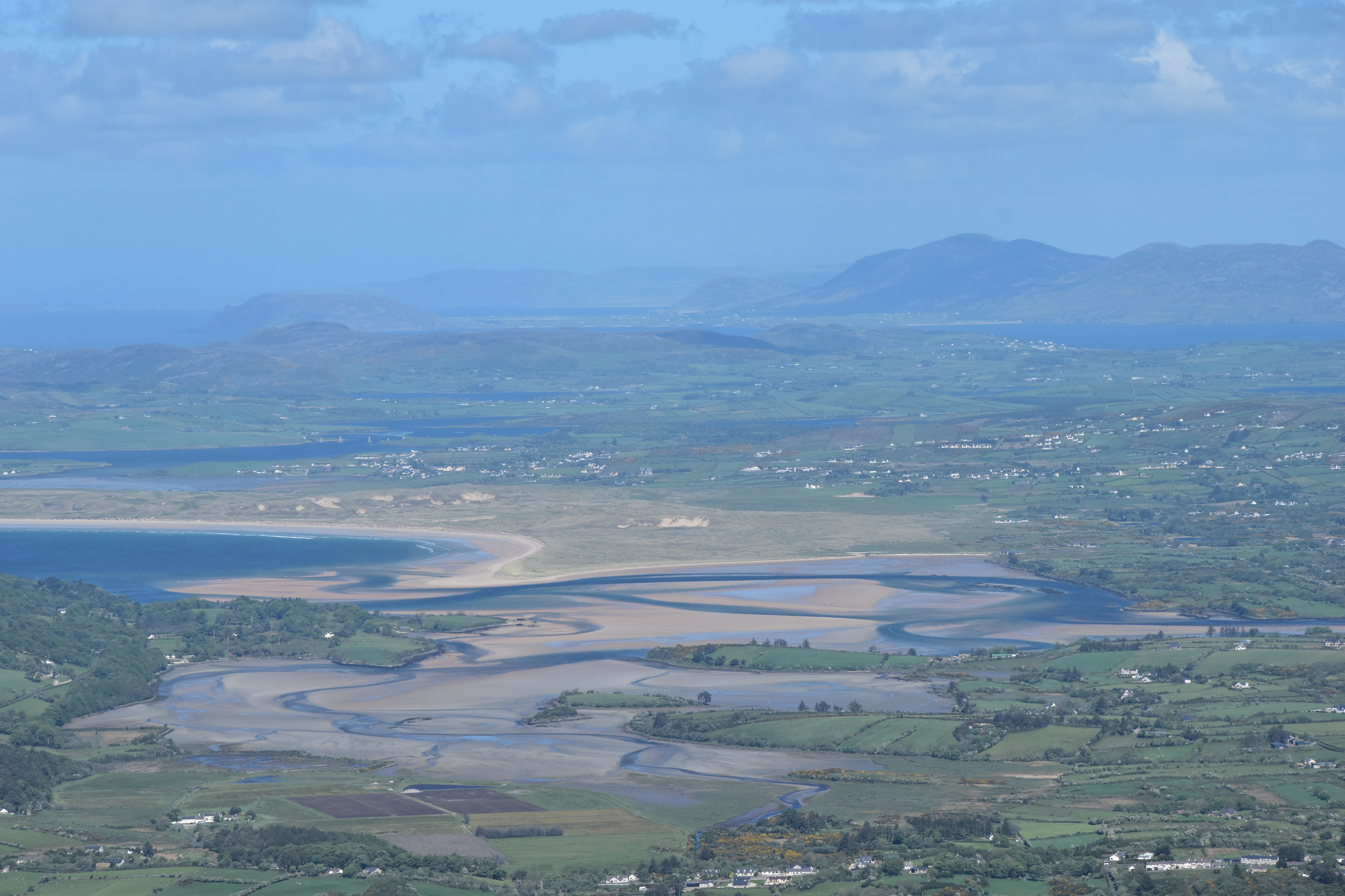
Since then, I always wanted to return up there. As a matter of fact, Muckish can be seen from everywhere in N Donegal. Its recognisable shape and its remarkable prominence draw the attention. And despite not having the splendor of Mount Errigal (751m), the highest peak of the county (which will definitely be the subject of a similar article later), Muckish is marked with history.

The fifth highest summit in the county, Muckish is the second highest of the Seven Sisters range, in the N of the Derryveagh Mountains, which stretches in a SW direction towards Mount Errigal. Its geographical position as the most northerly peak of the range means it stands as a beacon over the whole N coast of Donegal. Its gaelic name An Mhucais, literally “the pig’s back”, originates from its distinct shape. It is an elongated mountain, linked to the rest of the range by the eponymous col (Muckish Gap) to the S, through which winds the only road rising across the Seven Sisters; W of the col stands the famous “bridge of tears” (Droichead na nDeor), where families used to say their last goodbye to their relatives leaving for America or Australia during the 19th century.


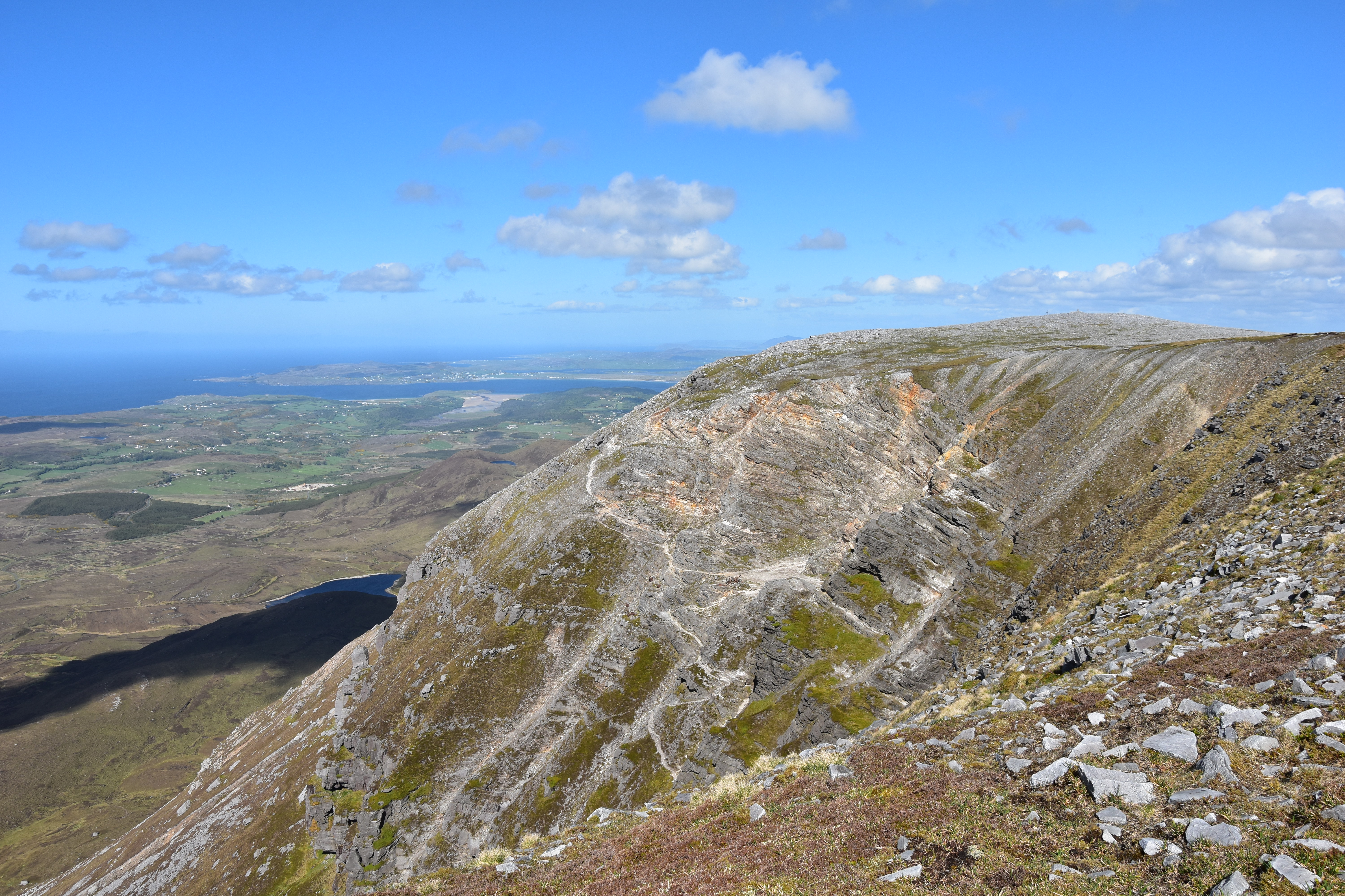
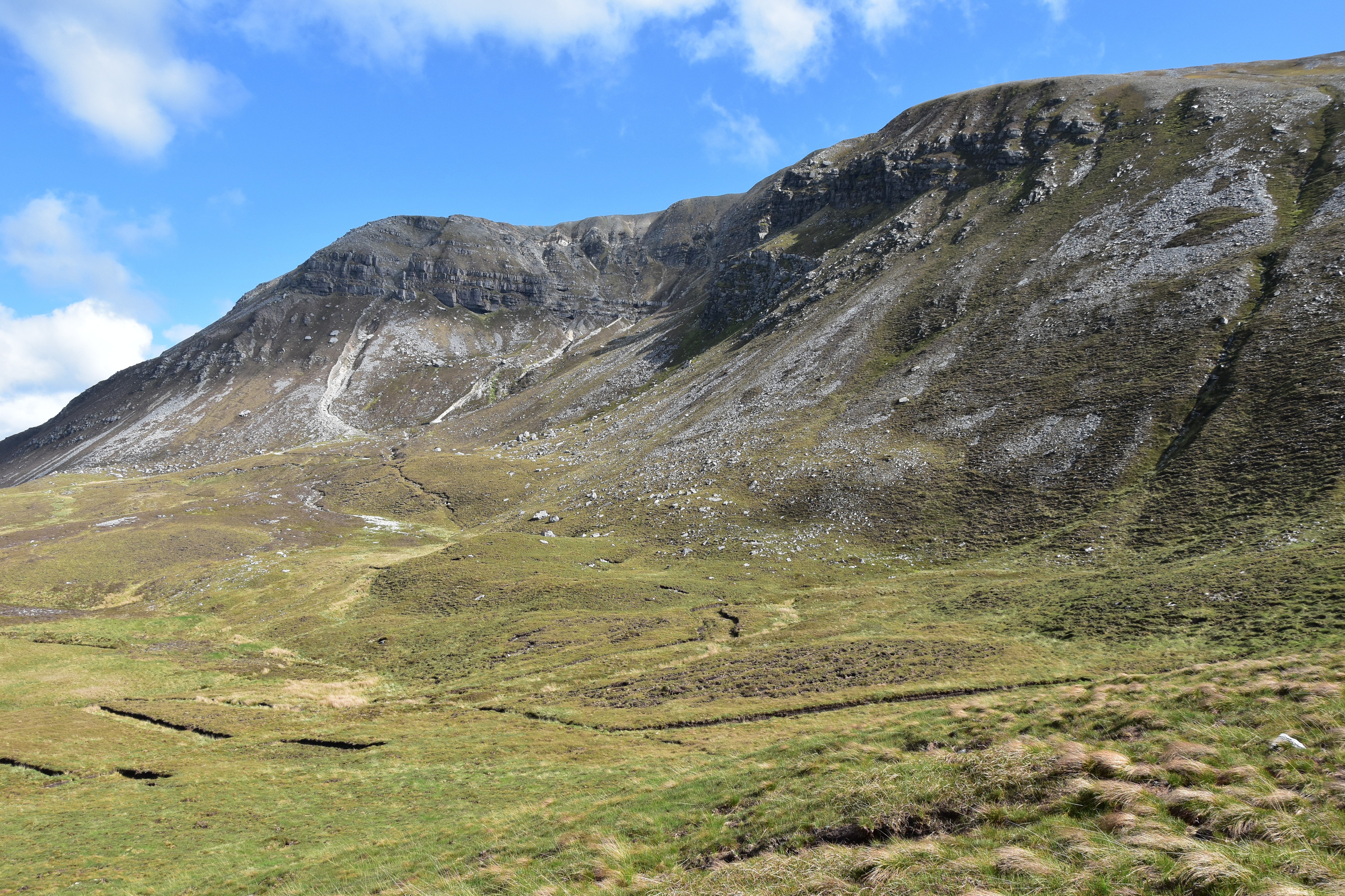
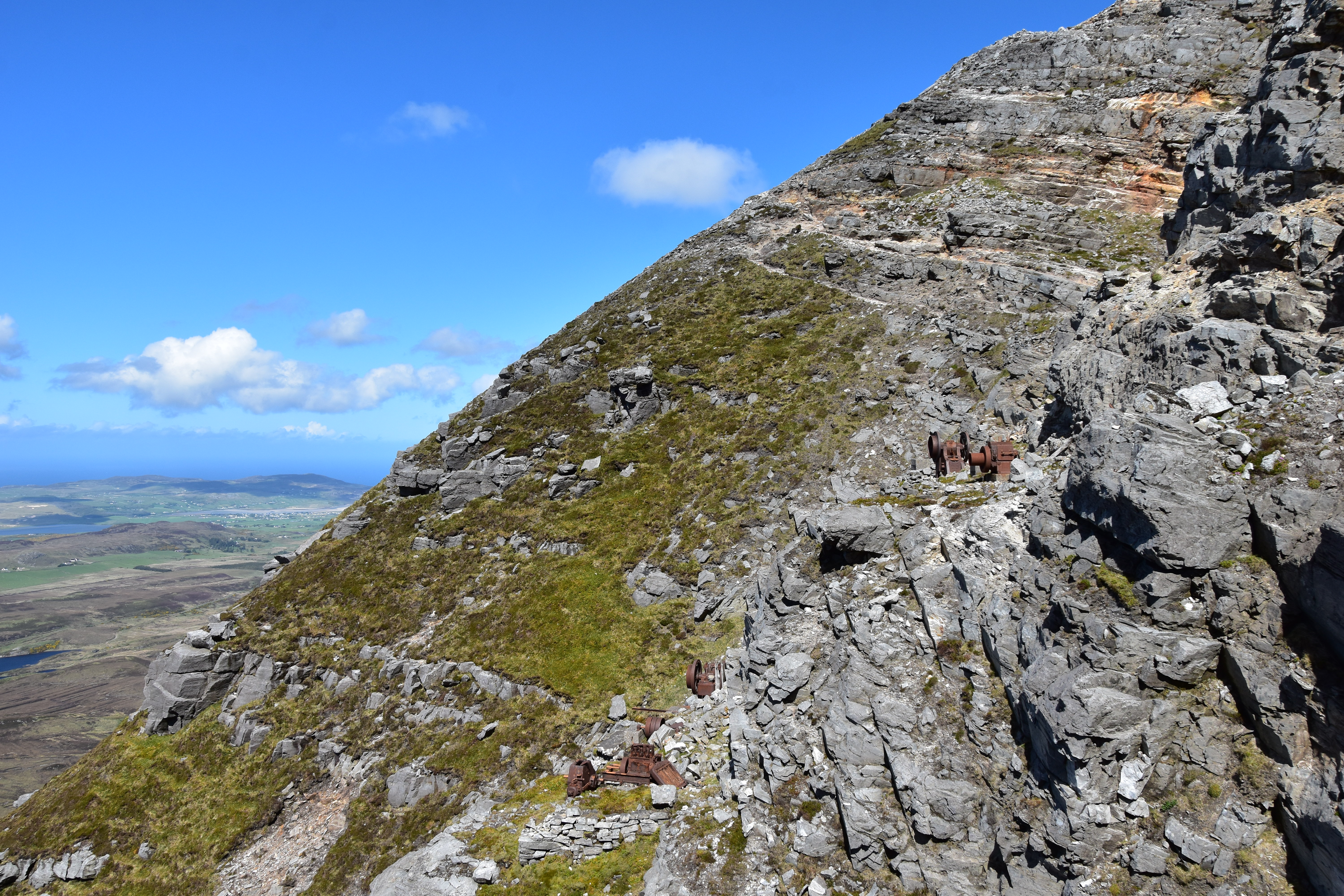
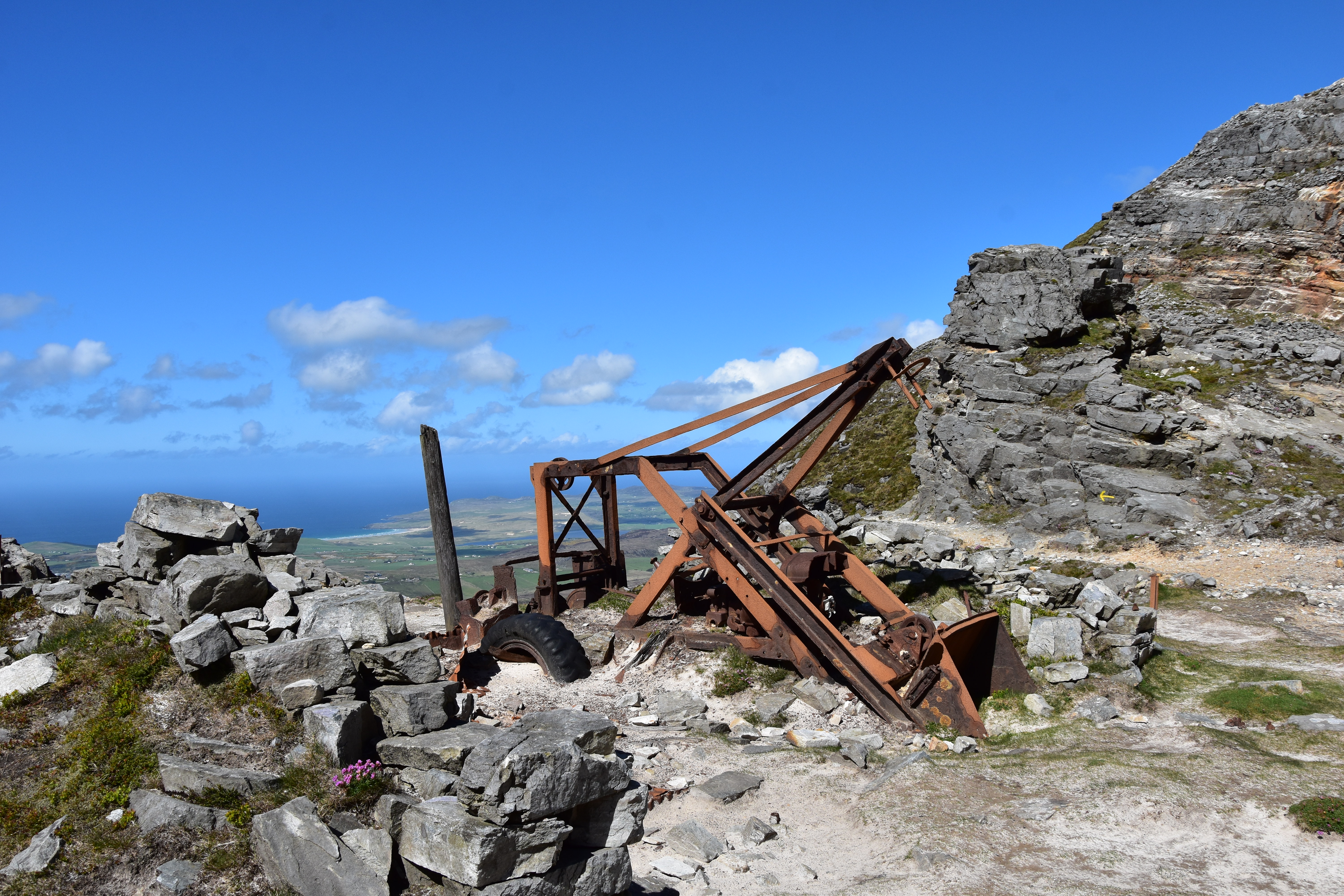
With steep slopes on every side, Muckish has remained wild and rugged. The two safest accesses are either from the gap to the S or from the S of Lough Agher and up the NW slopes. But the most popular route is the only path, which starts from the N: the Miners’ Track, which the miners used to climb to reach the quartzite mine situated around the 580m contour, a few hundred metres only from the summit. Doing this route in May 2017 was an unforgettable experience. The trail is steep, exposed in parts, and caution is required especially in windy conditions; the remains of the mining activity allow us to imagine the hardship of the miners’ task. The mine operated from the 1940s to 1952 and produced white quartzite of great quality, which was used in the optical industry.


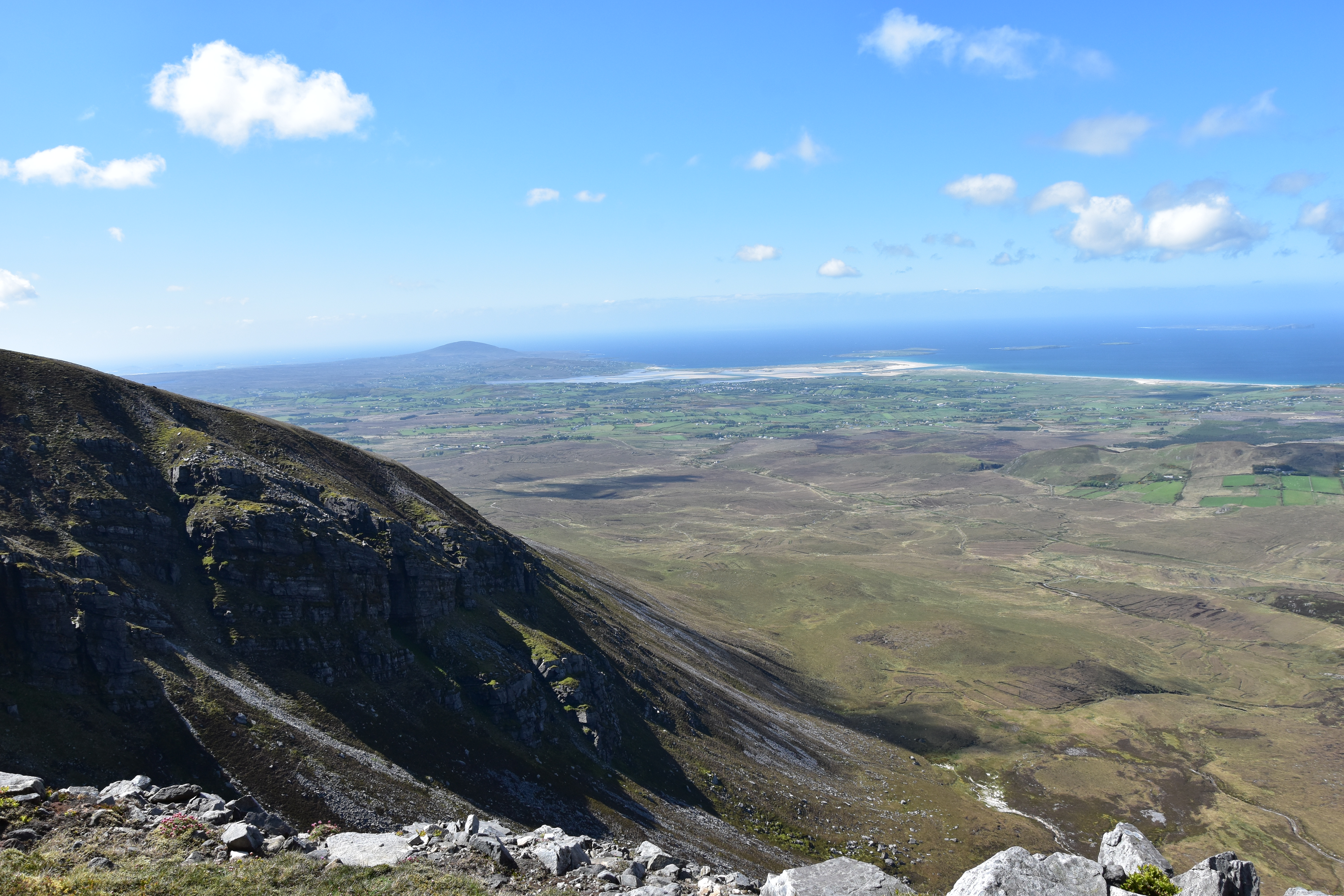
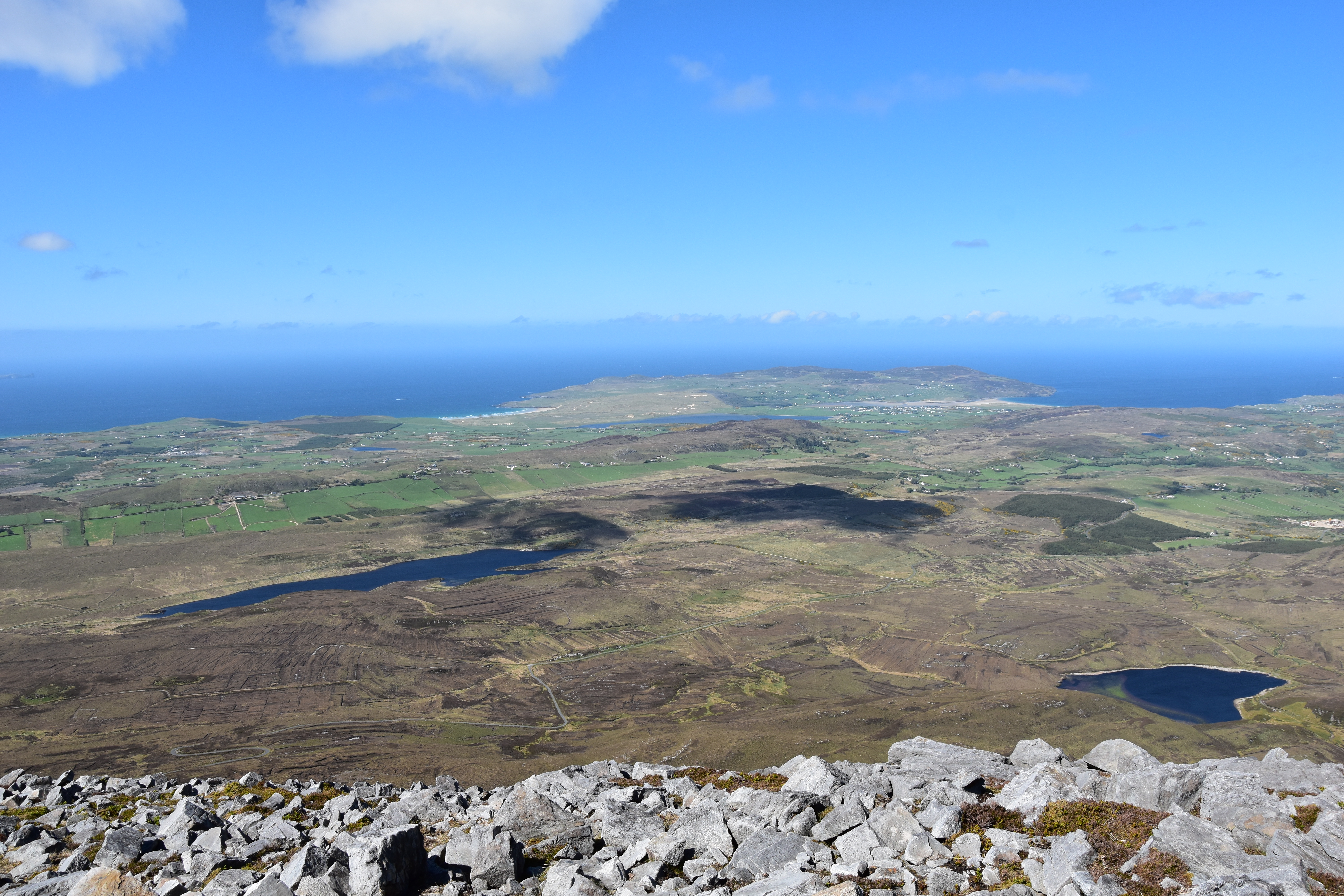
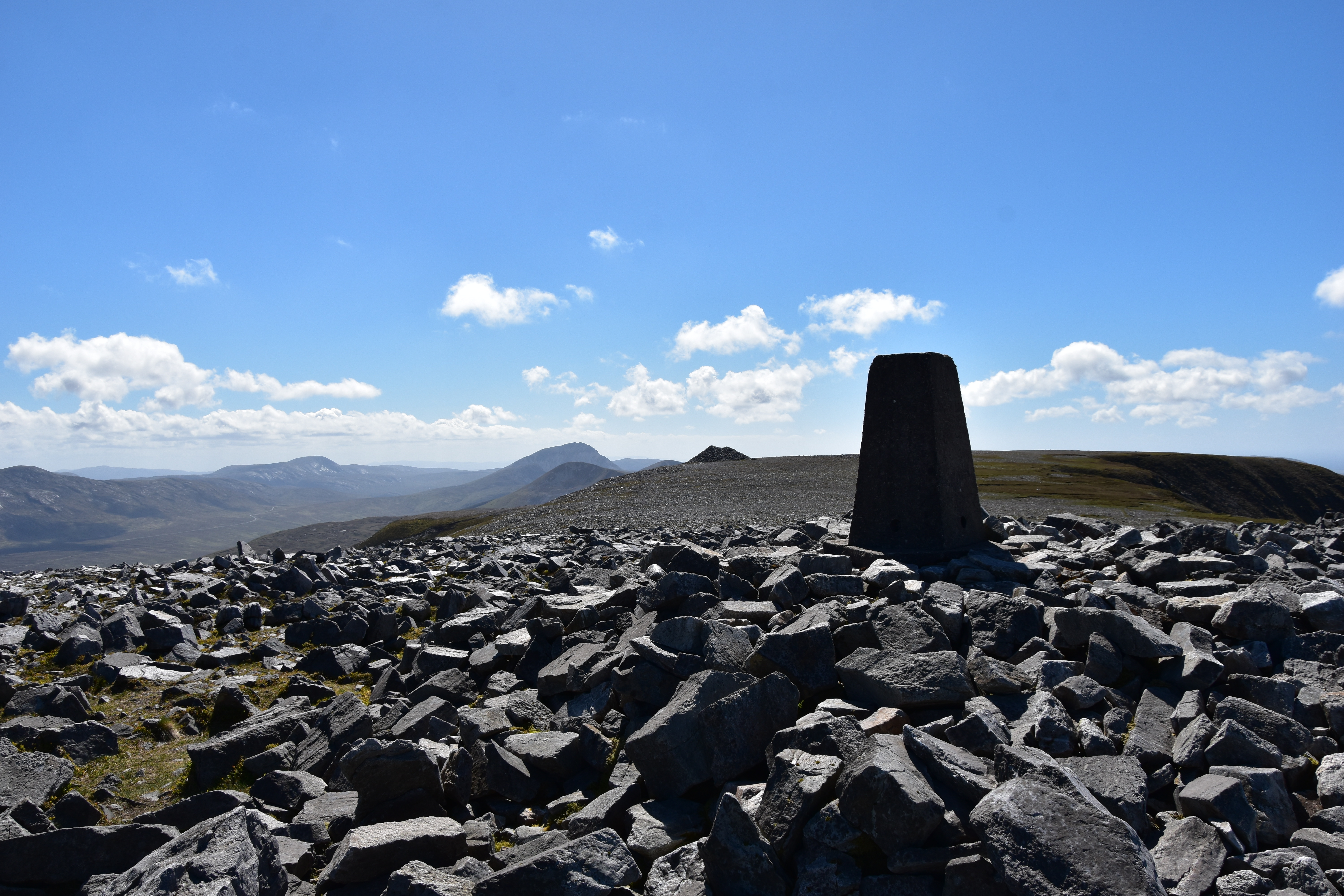
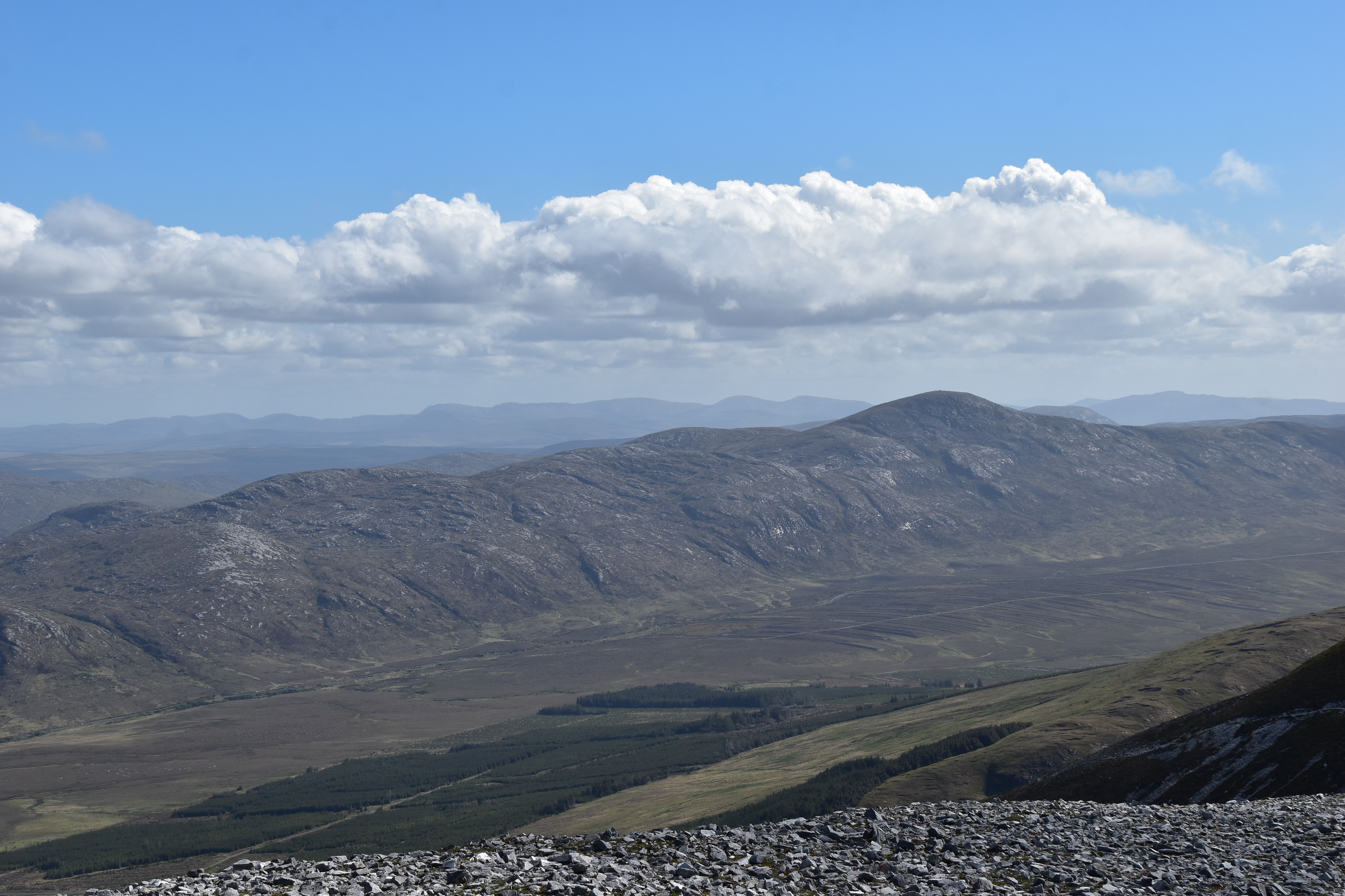
From the mine, it is a short walk up to the large summit plateau, a desolated, almost lunar landscape which is worth exploring under good visibility for its several, breathtaking viewpoints over the whole N of Donegal, passing by the massive, central cairn. The highest point is marked with a trig pillar and stands close to another cairn which is crowned with a large metal cross; this is arguably the best viewpoint, with a long stretch of the Atlantic Coast visible. Best saved for a clear day !!


Technical facts:
Name in English: Muckish
Name in gaelic: An Mhucais
Height: 667m
Prominence: 481m
County: Donegal (Republic of Ireland)
OSI grid reference: C00448 28709
My video:
Another video I heartily recommend:
And the best link for more information about the summit, routes and access:
https://mountainviews.ie/summit/163/
GPS track: Muckish via the Miners’ Track
Excellent post, I’ve done the miners track a number of times, keep an eye out for the spray paint arrows it’s easy to go off track on the way up & also keep your bearings on the summit as it can be difficult to find the path to get back down! (Especially if it becomes misty or foggy) stunning views & well worth the climb
Thank you Michael, definitely one to save for a clear day !! I’d say the way I came down is much safer than heading back down the Miners’ Track, although you need to mind your bearing to avoid getting close to the cliffs.
Great post. Did it from the south once and loved the summit plateau, really unusual. Would love to go back and do the Miners’ Track, looks great in these pics.
Thank you Martin !! This is a stunning route indeed and best is to keep it for a good (and not too windy) day. I was surprised to find quite a few yellow arrows showing the way along the path. It is steep and a bit exposed in places, but not as difficult as I thought (in good conditions). I must say that walking in the miners’ footsteps truly is an incredible experience. And the summit plateau is amazing indeed !!