1 – Na Sléibhte club walk, Connemara, co. Galway, Ireland, 3. February
First hike with the newly founded Na Sleibhte Hill-walking Club (“The Mountains’ Hill-walking Club”) which I have just joined. A club dedicated to challenge walks, long day hikes with significant distance and amount of climbing, which members must be reasonably fit and experienced and be able to navigate whatever the weather conditions. The concept is simple: one monthly hike in various mountain areas of Ireland; the participants meet at a defined starting point and can meet afterwards as well, but everyone chooses their own route and can decide on the day if they wish to complete it either with others or on their own. Alas for me, I landed in Ireland five days before with the flu (which caught me on the plane). After spending three days resting at the Letterfrack Lodge, a hostel located on the fringe of the Connemara National Park, with a few scenic drives as only outings, I finally make it to the top of Diamond Hill/Binn Ghuaire (442m), an iconic summit accessible via a well-maintained marked trail which allows to cope with the summer flood of tourists, on the Friday. In the evening, the few members of the club who took the drive to Connemara exchange tons of messages, as the weather conditions for the next day remain uncertain. Four members -including my good friend Daniel- decide to stick to the initial plan, which mainly includes the fantastic Sheeffry Hills, while three others opt for plan B, a longer walk (about 45km) with much less climbing, along the local, marked long-distance trail, the Western Way. As I can’t see myself doing any of the two, I make my mind for a shorter version of Plan B and arrange to finish with my three fellow members, Gerard, Kevin and Graham, who catch up with me about 4km before the end and give me a lift back to my car. Although I am still recovering from this bad flu, I am chuffed I was able to cover 31km in a beautiful scenery and under nice weather conditions !!

2 – Sheeffry Hills, Connemara, co. Mayo, Ireland, 4. February
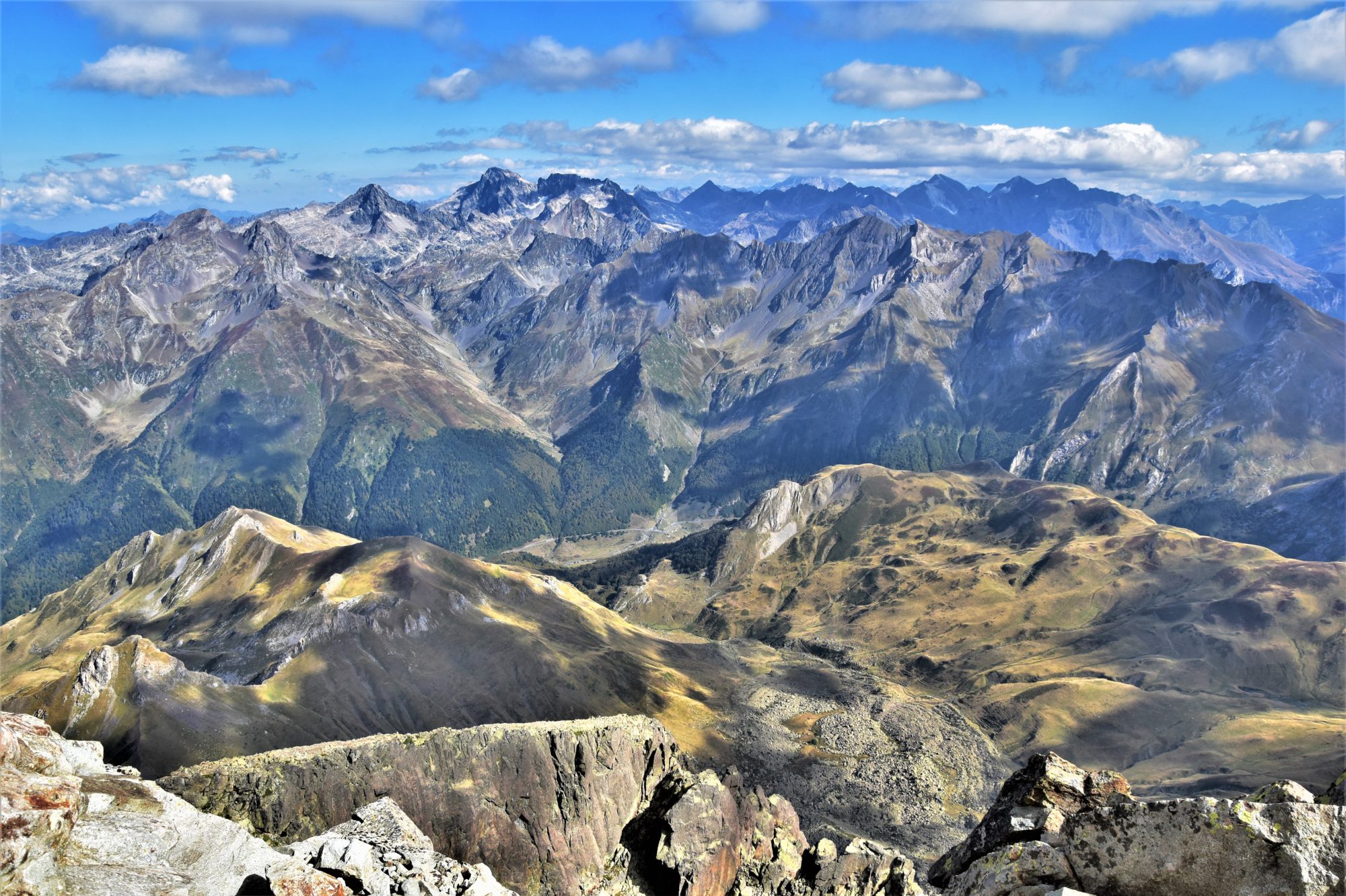
The next day, my friend Daniel has to drive back home to Belfast, but I ask him for a favour: I leave my car near Doo Lough and he kindly gives me a lift up to the Sheeffry Gap. This enables me to go and explore the Sheeffry Hills without having to complete a full loop. This remote mountain range, which is located in the N of Connemara, in S Mayo, offers me an unforgettable day out under amazing weather conditions, a mix of heavy clouds and blinding sunlight, a beautiful blanket of snow covering the top of the ridge adding to the incredible beauty of the scenery. I have plenty of time to enjoy and to film as well, some beautiful footage for a Youtube trilogy !!

3 – Sommet de Pouyaué, Central Pyrenees, 8. March
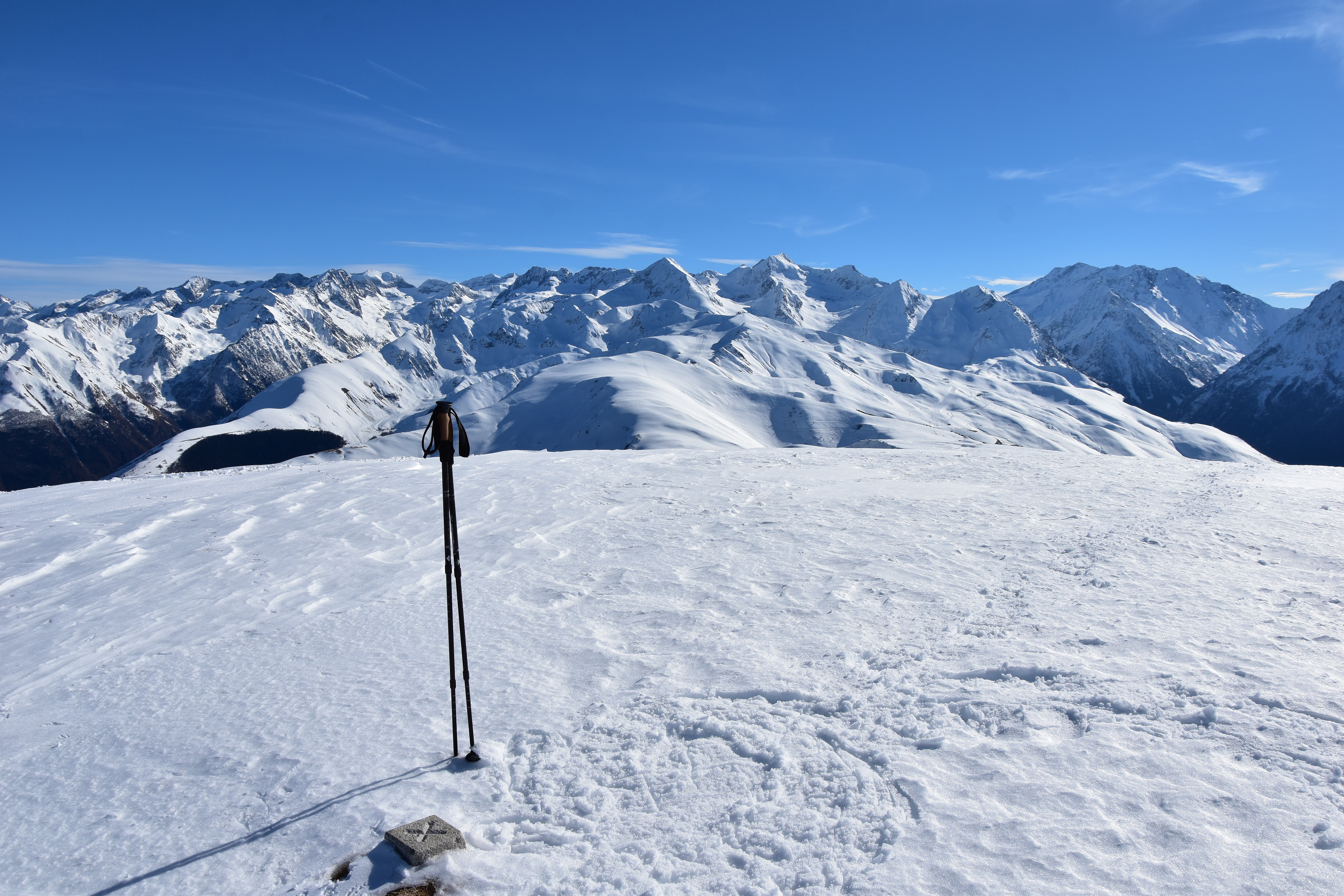
Hardly am I back in France that, inspired by this fantastic hike in the Sheeffry Hills, I buy myself a pair of snowshoes and decide to try them in the Pyrenees on a glorious day of March. To my surprise there is no snow left under 1500m and the Col de Peyresourde (1569m) is open !! This will be my first solo snowshoe outing, out and back along the ridge to the Sommet de Pouyaué (2062m), which I had already climbed in summer conditions back in September 2015. What a great feeling this time to leave my own trace in the snow, while taking in these vast, immaculate expanses of whiteness !! Another wonderful day out and another Youtube video !!

4 – Pen y Fan, Brecon Beacons, Wales, 27. March
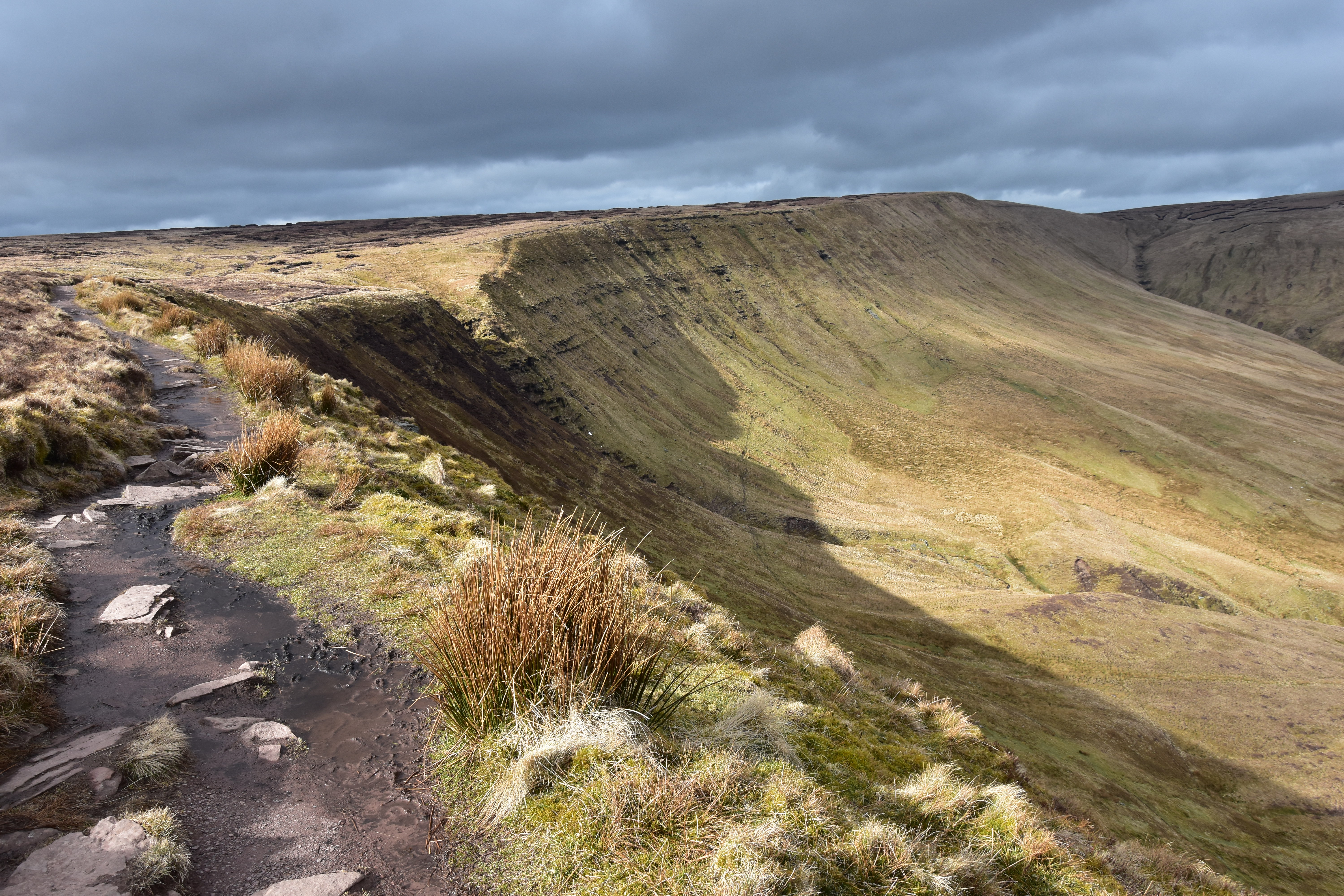
There is a purpose to my first visit in S Wales: I intend to buy a Berlingo with a conversion at the back, including a foldable bed and drawers, the idea also being, to have a right-hand drive vehicle I can use for my travels across the British Isles. As I wait for the money to get transferred, I decide to go and explore the Brecon Beacons. A long loop walk (36km, 9 summits) will take me from the village of Pontsticill where I am staying to the iconic peak of Pen-y-Fan, highpoint of the area at 886m. A beautiful hike under cold, moody yet dry weather.

5 – Ullswater Way, Lake District, England, 30. March
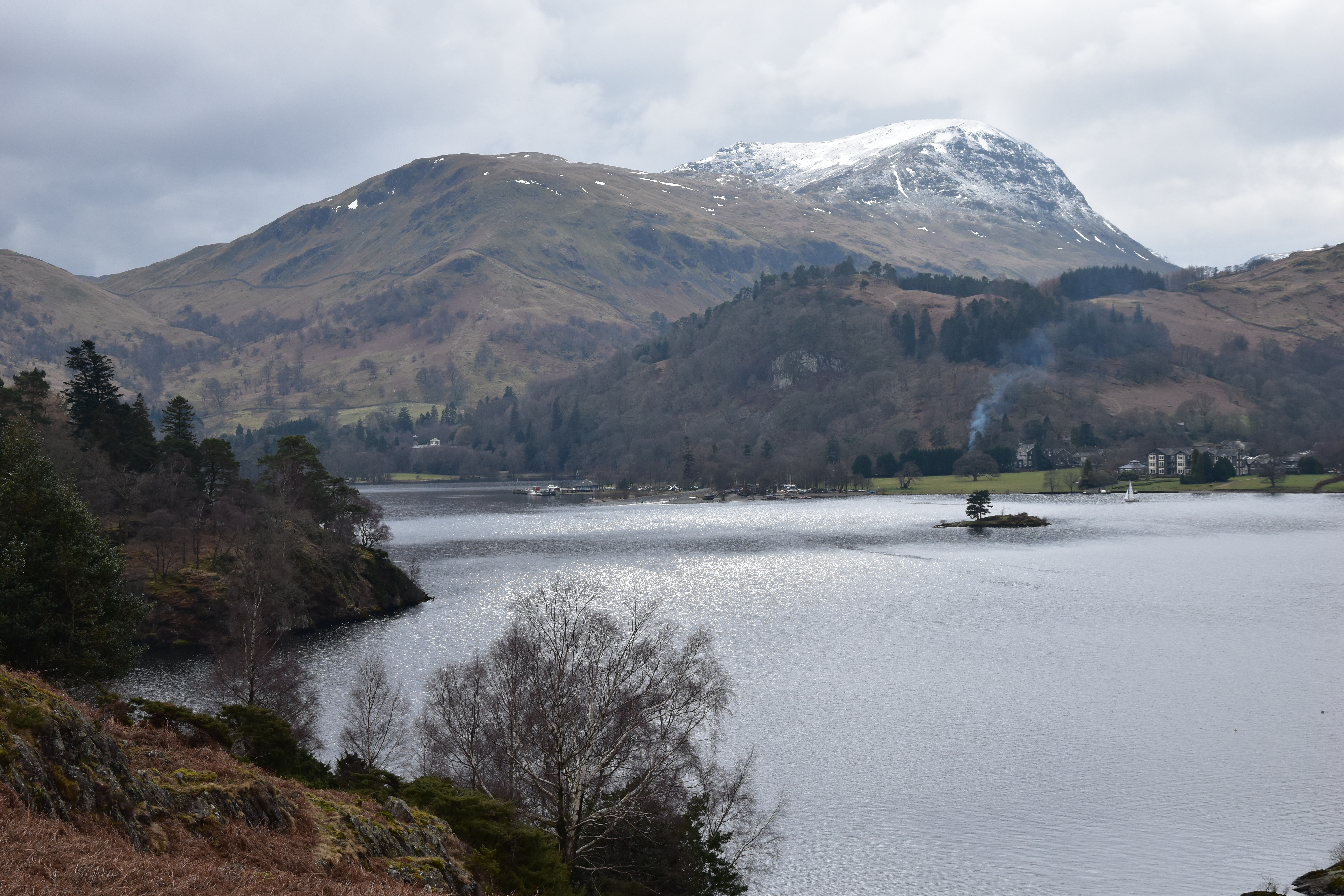
Comfortably sat at the wheel of my new car, I head for the N of England and meet with my friend Jay for another long walk around Ullswater, an elongated lake at the foot of the mountains of the Lake District. Despite a detour to the top of Gowbarrow (481m), one of the 214 wainwrights (a list of summits of the Lake District, compiled in the 1950s/1960s by Alfred Wainwright, a famous British hiker and author), the route is not a difficult one as the marked trail is very easy to follow; but this does not prevent us to enjoy some beautiful views over the lake and the surrounding mountains all along the way.

6 – Bonscale Pike-Wether Hill, Lake District, England, 1. April
For my last day in the area, I opt for a rather reasonable route, which still allows me to add 6 wainwrights to my collection: Bonscale Pike (524m), Arthur’s Pike (533m), Loadpot Hill (672m), Wether Hill (674m), Pikeawassa/Steel Knotts (432m) and Hallin Fell (388m). Another beautiful hike which is also the subject of two videos on my Youtube channel.

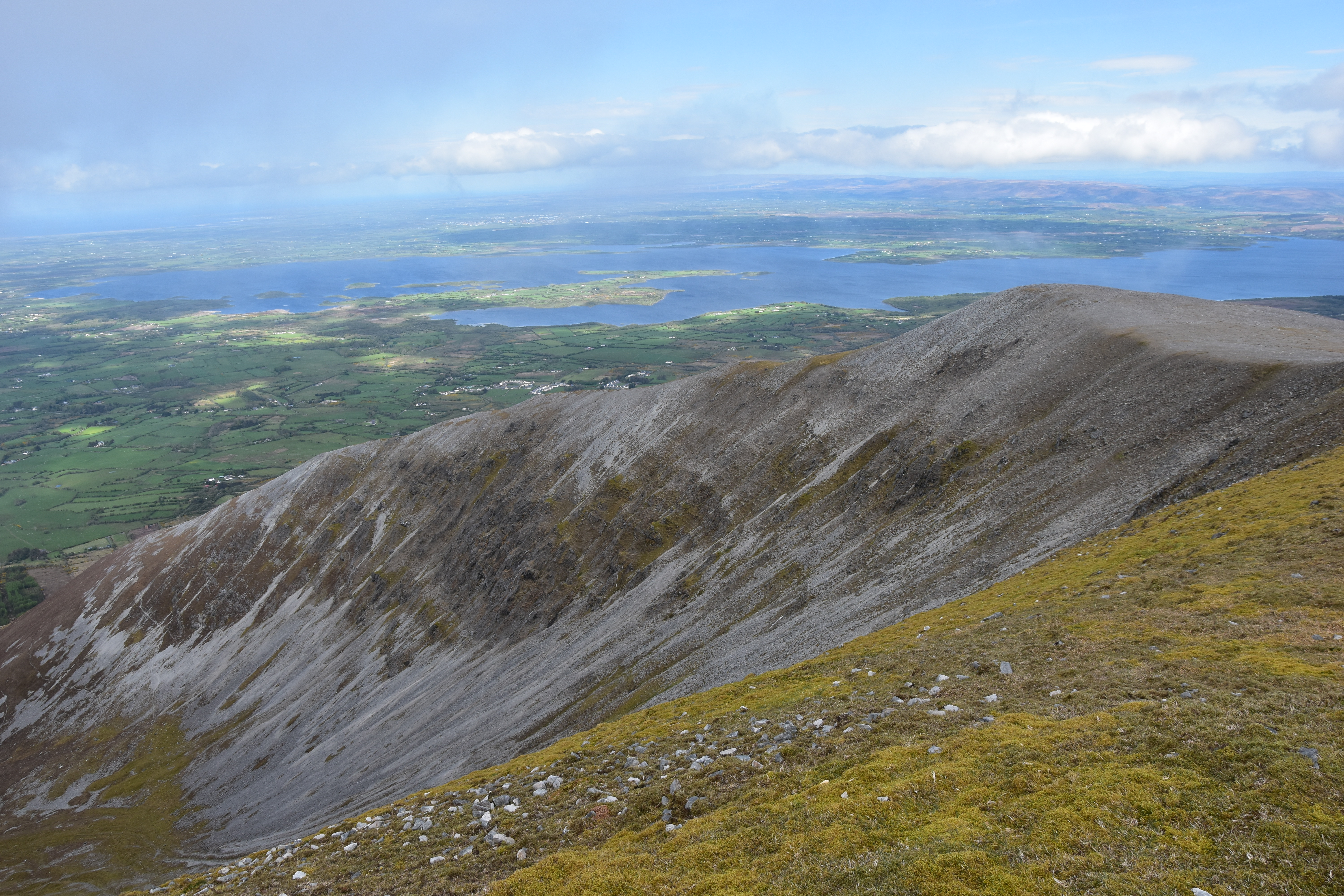
7 – Na Sléibhte club walk, Nephin Beg Range, co. Mayo, Ireland, 5. May
Second encounter with the Na Sleibhte Hill-walking Club, in the superb Nephin Beg Range in co. Mayo, in the W of Ireland. While the fittest opt for a full traverse, which includes the most remote of all Irish summits, I decide to shorten the journey after spending the whole morning in the clouds, as to enjoy a bit of sunshine and the stunning views from the Bengorm ridge, adding a few summits to my collection. My only regret of the day: crossing the impressive, sharp-edged Corranabinnia ridge with no visibility…

8 – Nephin, co. Mayo, Ireland, 7. May
Before leaving co. Mayo, I meet a fellow hiker I had been exchanging with for a while on Facebook, Justyna. We head for one of the most iconic peaks of the area, Nephin (806m), which is not only Connacht’s second highest mountain after the elusive and remote Mweelrea (814m), but is also Ireland’s highest standalone mountain, just a short distance away from the Nephin Beg massif. Its ascent proves to be rather spectacular, although it is not really difficult, and the vista from the summit area over the surrounding lakes, plains and mountains is absolutely breathtaking !! After the walk we pay a short visit to Derek Davidson, who offers some amazing accommodation and guided tours and hikes all across co. Mayo via his own company, Walk West Ireland. Another brilliant encounter !!

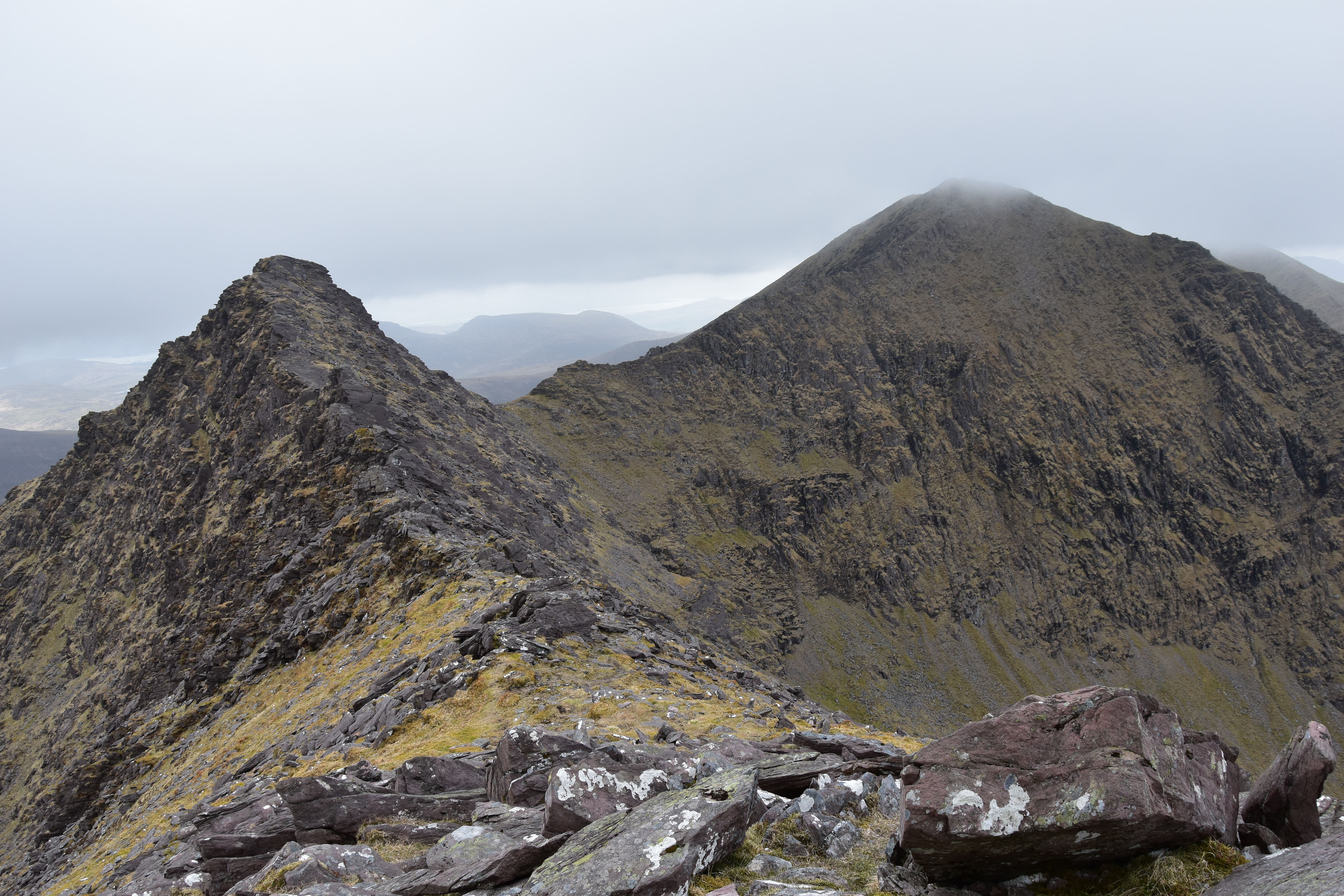
9 – Cruach Mor-Cnoc na Péiste, Eastern Reeks, co. Kerry, Ireland, 13. May
Arguably one of the most spectacular hikes in Ireland, in the McGillicuddy’s Reeks, facing Ireland’s highpoint, Carrauntoohill (1038m). A tricky route, which includes 6 of the 12 highest mountains in Ireland, allowing me to complete the full list of 14 Irish +900m peaks. The crux of the walk is the Cruach Mor-Big Gun-Cnoc na Péiste traverse, looking even more impressive due to the dull weather, with a touch of scrambling, slightly exposed at times, although I find a way to contour the trickiest bits. The final ascent to the summit of the Big Gun, even via the “easy” route, requires a head for heights. Once on the top of Cnoc na Péiste, Ireland’s 4th highest summit at 985m, the ridge widens and a proper trail appears, allowing for a much easier finish.

10 – Carrauntoohill, McGillicuddy’s Reeks, co. Kerry, Ireland, 14. May
Back at the hostel after my adventures in the Eastern Reeks, I get to chat with a Canadian lady in her fifties named Linda, who tells me she would like to climb Carrauntoohill (1038m) the next day, but is not too confident as she is not really used to hike in the mountains. I offer to join her. The following day we start from Cronin’s Yard. A few hours later, despite the views being restricted by the clouds, she is proudly standing on the top of Ireland; as for me, I am delighted too, even though this is my third time up there, and will not be my last (I will have the immense pleasure to also take my good friend Alexandre and his two young teenage kids to the top a few months later). While chilling out on the summit, a young couple asks me which way to go to access the ridge leading to Beenkeragh (1008m). I explain to them I did it under good weather conditions back in 2015, and that given the present lack of visibility, the difficulty and the exposure, I would strongly advise them not to venture on the said ridge unless they are very experienced hikers. After a good 30 minutes, it’s time to head back and I tell Linda to start going down while I take one last video; as she is not heading where she should be, I tell her “Linda, just follow the trail along the large cairns over there”. Her face suddenly turns pale as she figures out she could have got lost. Or even worse. Because she knows that Carrauntoohill, despite her modest height, is a dangerous mountain with sheer drops, which claims several lives every year. Later, as we make our way down, we can hear someone calling in the distance… The next day, as she is waiting for her flight at Dublin Airport, Linda, shocked, sends me a link. A young Canadian in his thirties fell to his death from the Beenkeragh Ridge the previous day, right under his partner’s eyes, around the time we were going down the Zigzags, on the opposite side of Carrauntoohill. We will never know if it was the couple we talked to, but as I said to Linda, I just did my best to dissuade them…

11 – Glenbeigh Horseshoe, co. Kerry, Ireland, 16. May
After a rainy day, the weather forecast looks good for Kerry. This time I start from the hostel, aiming at completing the whole Glenbeigh Horseshoe, a +40km loop walk which takes in a total of 12 summits, with over 1800m height gain. In all, over 14h walking, of which about 12h30 without meeting a single human soul, nor crossing a single road. The route is rather easy-going despite being mostly off-track, with an exhilarating addition: a spectacular out-and-back trip on a narrow ridge leading to the summit of Keamconneragh. A bit annoyed after having started later than planned (which I knew meant I would finish after nightfall), I finally see the interest of a later start as I stand amazed at the fantastic sunset over Dingle Bay from the top of Drung Hill, the last summit of the day !! An outstanding day out, which has been the subject of a series of four videos !!

12 – Blackstairs Challenge, Blackstairs, Leinster province, Ireland, 19. May
After having taken part to this challenge walk the previous year, I hadn’t necessarily planned to be back for the 2018 edition, but to my surprise I won a free participation while taking part to a photo contest on the Wayfarers’ Facebook page. It was thus a real pleasure to meet Daniel and some other members of the Na Sléibhte Club again for another brilliant day out, under a glorious weather and with, as usual should I say, a brilliant organisation and warmful atmosphere from the Wayfarers. This was also for me the opportunity to meet John, one of the most prominent members of the MountainViews website. Pretty fit after two weeks of intensive hill-walking, I pick up the pace in the second half of the walk and finish with a time under 7h30, i.e. a good hour less than the previous year !!

13 – Snowdon Badger Meeting, Snowdonia, Wales, 5. June
After a mere two hours’ sleep on the night ferry crossing from Dublin, I arrive early in the morning in Llanberis, in the mountain area of Snowdonia in N Wales. After a hearty breakfast I join Helen and Jay, whom I had met in the Lake District the previous year, and another ca. 50 “badgers” -named so because most of them wear a “Walk 1000 miles” badge (from the eponymous FB group, created by the famous British magazine Country Walking). All these walkers have one aim: climbing Mount Snowdon (1085m), highpoint of Wales, via the easiest way, the Llanberis Path -note that the event is organised independently from the magazine itself, and that everyone is aware and has agreed that they were responsible for their own safety. This does not prevent the composition of small groups which each include one experimented walker. I am thus in charge of leading Anna, Eli, Mandy and Janie to the summit. My task is mostly to encourage them, and also to reassure them in case something happens or the weather changes suddenly. Fortunately the weather remains glorious, and the ascent on the wide track offers no real difficulty apart from the distance and the fair amount of climbing. About halfway, Janie decides to join two other walkers with a similar, slower pace, but after reaching the top, I come back down about 100m to make sure she is getting there. We all get pretty emotional, as it is for most of them a big challenge to climb a proper mountain -all the more the highest in the British Isles outside Scotland- and I will never forget the happiness and pride of the last walkers as they reached the top. Another day filled with wonderful encounters, and a special thought for the other Helen, who had first launched the idea but had to give up halfway due to a reluctant knee, I know you will make it one day !!

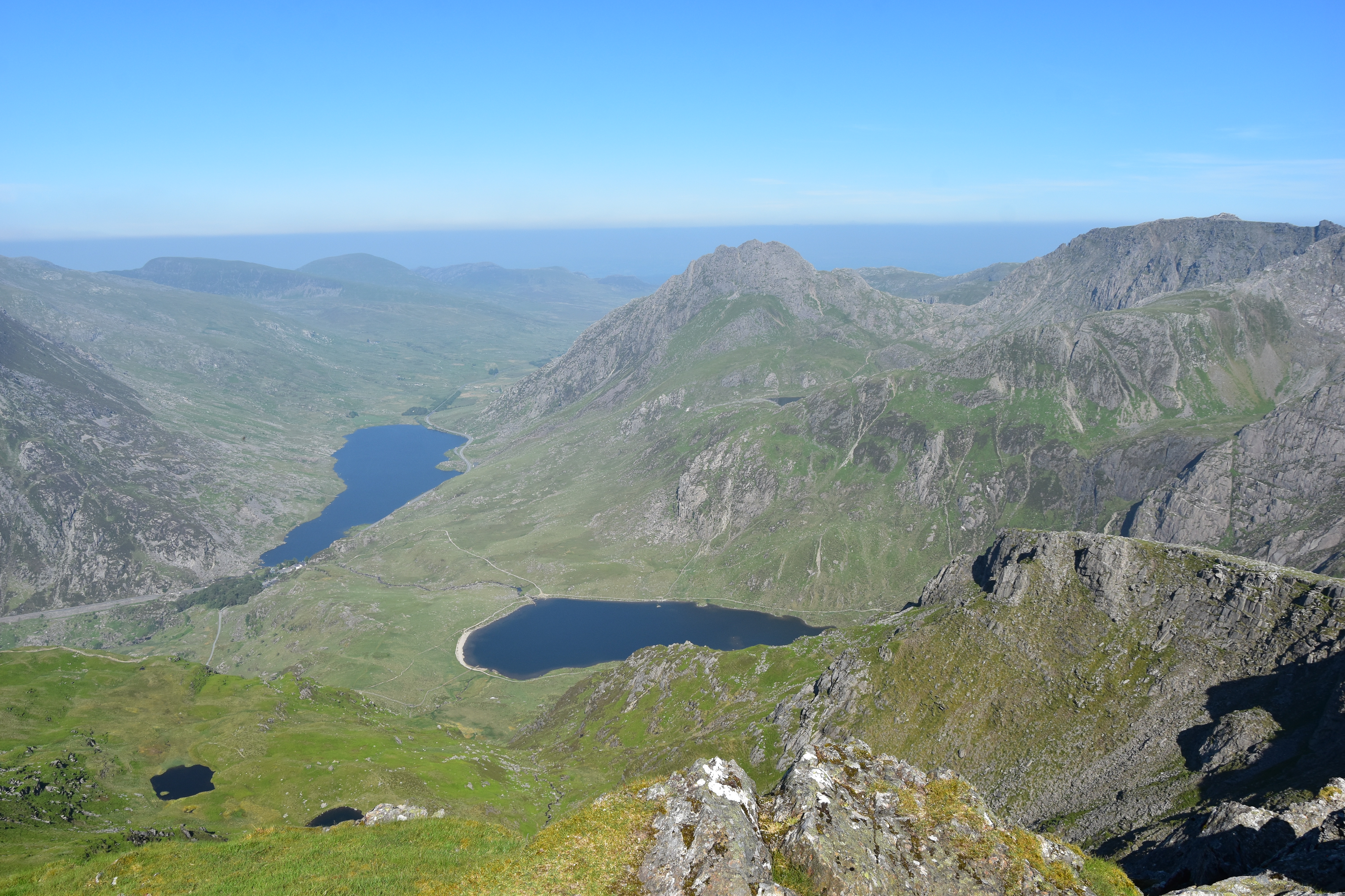
14 – Glyderau, Snowdonia, Wales, 6. June
The next day I meet my friend Jay for a long hike across the Glyderau massif. The weather has turned hot, and after an out-and-back trip to Elidir Fawr (924m), Jay decides to turn back down and drive home. I continue on my own towards Y Garn (947m), but the rest of the route is bound to be more arduous. Ascending through the scree to the top of Glyder Fawr (1001m) is pretty tough-going, but what a vista from the top !! After a short scramble to climb the rocky outcrop of Castell-y-Gwynt, Glyder Fach (994m) is the last summit of a demanding hike. My quest to conquer all 15 Welsh +3000ft summits has truly started, but Tryfan (915m), which I should have climbed that day for the second time (first time was in 2004) will have to wait for another few days !!

15 – Snowdon Horseshoe, Snowdonia, Wales, 8. June
After a well-earned day off I am back in the mountains. The challenge of the day: the Snowdon Horseshoe, definitely not a hard walk in terms of distance or amount of climbing, still the first part includes the traverse of the most famous arête in Britain, Crib Goch (923m). The first part of the scramble already gives me shivers, but the arête itself is even more impressive: to the right, a sheer drop of several hundred metres; to the left, the slope may not be vertical, but is scary enough. I first try to contour the arête to the left but as this sounds more dangerous, I am soon back on top of the knife’s edge. I sit down for a while to calm down a bit and watch the progress of a group of seven walkers supervised by a mountain leader. I decide to follow them but soon find out that on dry and solid rock and given the good weather conditions I actually feel more comfortable than them !! I pass them by as I reach the top and keep on walking until a series of pinnacles which I contour, suddenly totally alone in a desolated landscape !! Then comes the crux of the traverse: a treacherous scramble along the edge of a cliff and up the last pinnacle, followed by a short scramble down. After Crib Goch comes the long ascent towards Garnedd Ugain (1065m), with a few more bits of scrambling. From there it is then only a few minutes’ walk to Snowdon (1085m), which top I reach for the third time. The last part of the walk is the fun ascent of the twin peaks of Y Lliwedd (889 and 893m). An epic route with some breathtaking viewpoints, which was worth a video !!

16 – Carneddau, Snowdonia, Wales, 10. June
After having climbed Tryfan (915m) and a few other peaks the previous day, I still have 7 summits left out of the 15 Welsh +3000ft I had planned to ascend over the week. This is definitely going to be a long day, all the more because I have decided to enjoy a bit of scrambling as a starter, a famous yet not too frequented route, the spectacular arête of Llech Du. After leaving the main trail, the access to the beginning of the scramble is not obvious. Fortunately, I meet Alan, which steps I am happy to follow. There is also a couple with a dog behind us, but not another soul around !! The ascent proves to be pure delight as I feel really confident, although still very cautious. Alan and I get to chat a bit on the final part of the walk up Carnedd Dafydd (1044m, I must say it is rather nice to climb a mountain which bears my name !!), where we then part. I then take in the next 6 summits, including the mighty Carnedd Llewelyn (1064m). The last three do not require a lot of ascent though, and I still have enough time and energy left for another 4 new summits. I end up with a sunset from Gyrn Wigau (643m), which I had already climbed two years before with my son, to whom I send a video, feeling really emotional. With almost 35km, a total height gain of 1650m and 12 summits bagged in 11h, this is one of my biggest hikes of the year !!

17 – Ben Nevis via CMD (Carn Mor Dearg) arête, Scotland, 21. June
After a few days with my English family near London, it is time to head to Scotland !! The good weather allows me to enjoy five walks in five consecutive days. On the fourth day, I am off to climb Ben Nevis (1345m) for the second time (my first ascent dates back to 2003), this time via the famous CMD arête, a sharp-edged ridge which connects Carn Mor Dearg (1223m) to Ben Nevis. A long and spectacular route, yet with no technical scrambling and no real feeling of exposure. The terrain is demanding though. After an initial +770m to the Mountain Rescue Hut, the +450m off-track ascent to reach the main Carn Mor Dearg ridge are brutal, the steep slope reaching around 50% in places (that is about 25/27°), and the terrain on the final pull up Ben Nevis after the fun traverse of the arête mainly consists of boulders and scree. The highpoint of the UK will unfortunately not clear up completely, but the vistas during the ascent and descent will remain forever engraved in my memory. Once again, don’t hesitate to watch my video !!

18- Bidean nam Bian, Glencoe, Scotland, 22. June
The last Scottish outing of the season will prove to be as tough as the previous one, with a total amount of climbing also approaching 1600m. This hike will bring its lot of sensations: seldom had I felt such a feeling of remoteness and felt so small, in an incredibly imposing landscape. Reaching the flat and ominous Lost Valley, encircled with steep rocky slopes and where the stream disappears underground before reappearing further down is already intimidating. Then, just like the previous day, a +500m off-track slog awaits me, during which I have to contour a large herd of wild deer, to reach the cloudy Beinn Fhada ridge, where I then struggle a bit to find the (easy) scramble to the top of Stob Coire Sgreamhach (1072m), the first of the two munros of the day. And once up there it all becomes magical: the clouds start lifting, uncovering, just like the previous day, endless lines of mountain ridges as far as the eye can see. But the walk reaches its climax a little later, as I reach the highpoint of the Glencoe area. Bidean nam Bian (1150m) is a mythical and spectacular summit, and I quiver every time I say her name out loud; as for the vista, it is absolutely breathtaking !! I take the time to visit another few summits before descending for what seems like ages. I could not have dreamed of a better end to my trip !!

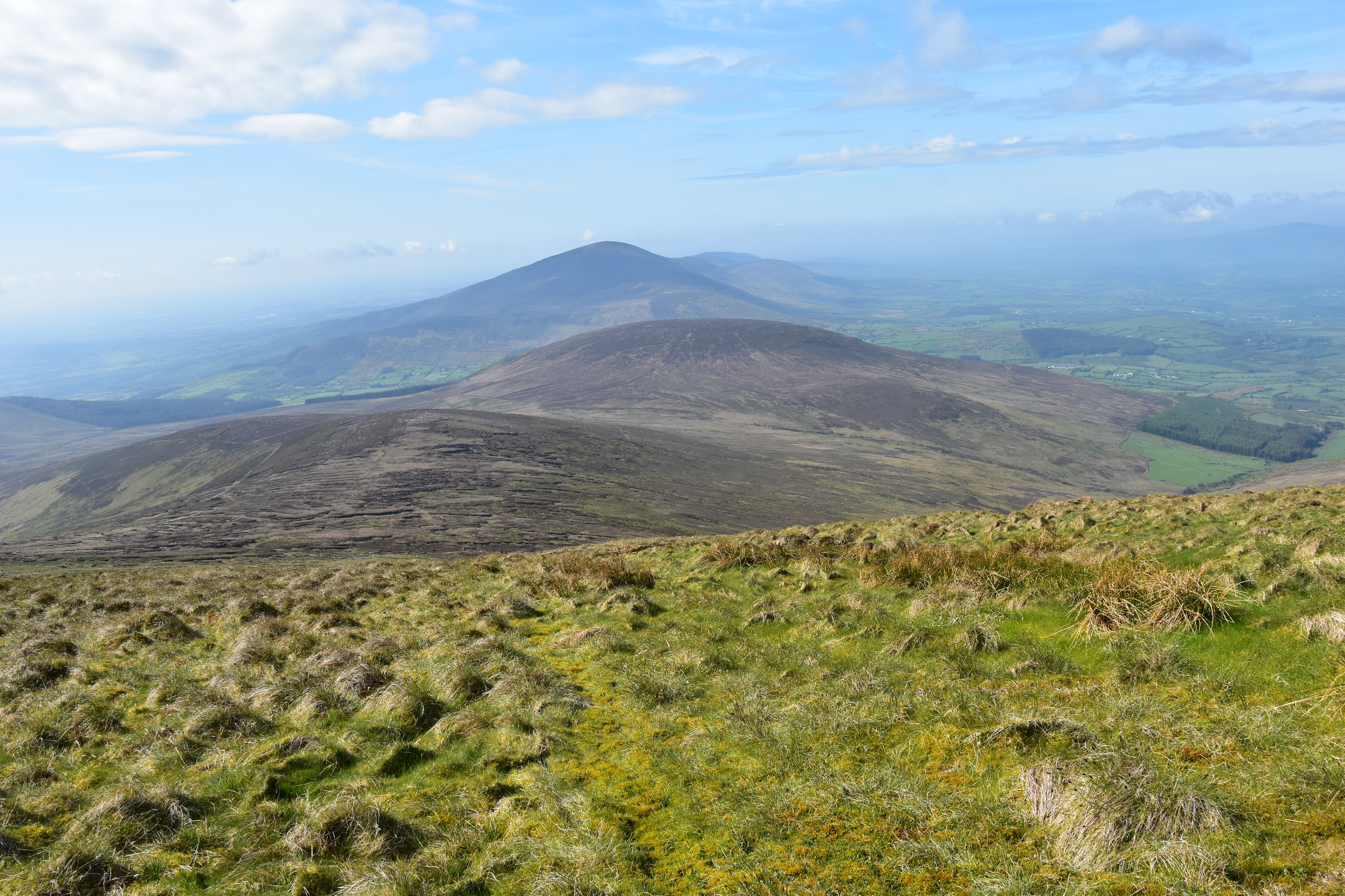
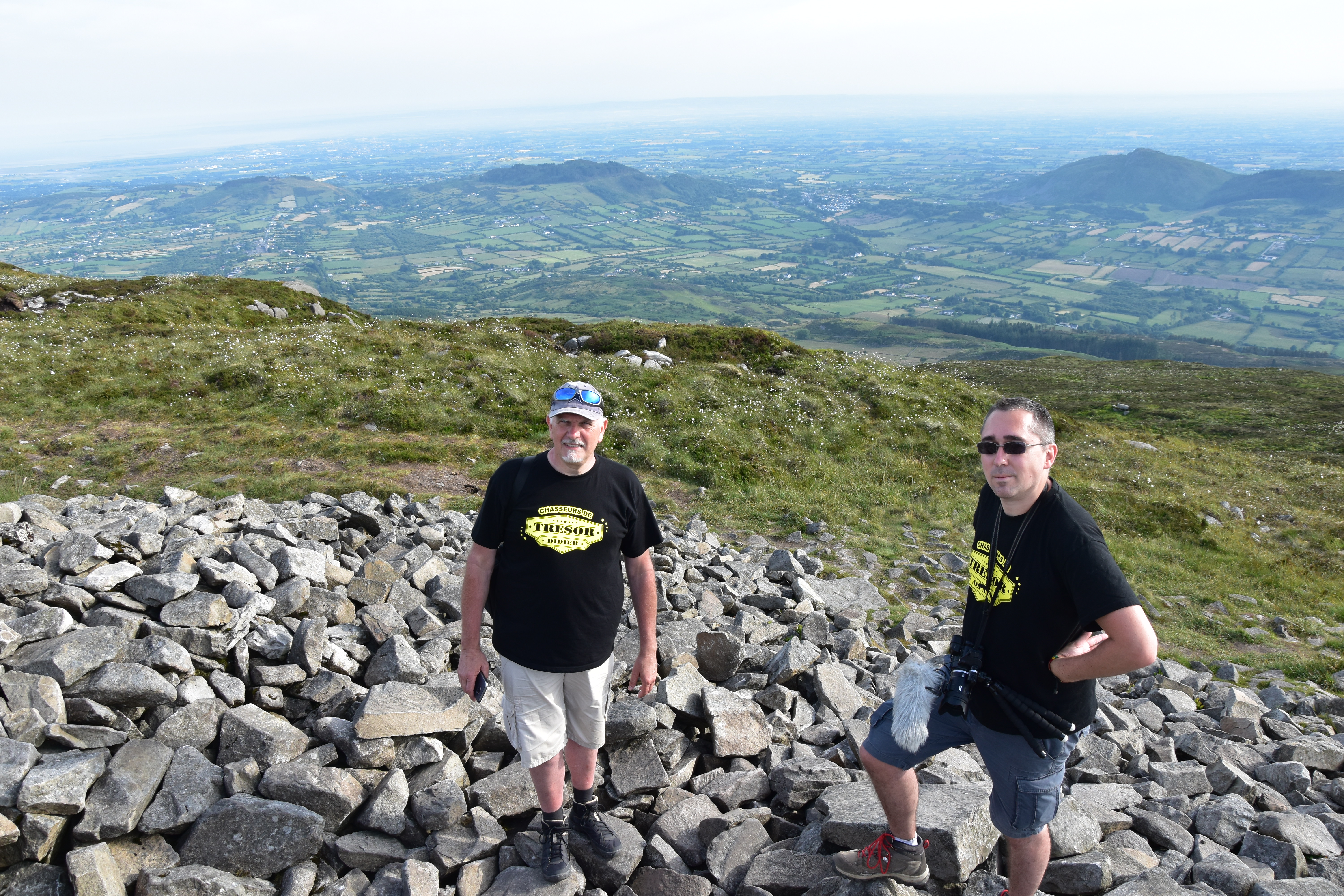
19 – Slieve Gullion, co. Armagh, Northern Ireland, 25. June
After my Scottish adventures I catch a ferry to Northern Ireland. A special duty awaits me: I am going to guide Didier and Alexis, from the Youtube channel “Chasseurs de Trésor” during five days in Ireland. They haven’t brought their metal detectors though as they know this activity is strictly forbidden on the Emerald Isle. But the island is swarming with ancient sites and archeological treasures which I am eager to show them. On our list: ruined abbeys, ancient crosses, forts, tumulus, carved stones, dolmens, stone circles… and an ancient passage tomb, located on top of Slieve Gullion (573m), highpoint of county Armagh. I had already climbed this summit a few years ago under the rain; but this time, the weather is fantastic (actually a scorcher !!) and they have brought their drone. There is a mere 200m to climb but the two lads are having a ball and pretend to faint every 10m. Once on the top, we visit the passage tomb which is at least… 5,000 years old !! Alexis and Didier will release a series of videos retracing their trip, including one which tells about this unforgettable ascent !!

20 – Tour d’Oueil-Larboust, Luchonnais, Central Pyrenees, 14. July
Back home after about three weeks away in the British Isles I am seriously thinking of completing a challenge walk in the Pyrenees. The Tour d’Oueil-Larboust has the required profile: this marked trail is usually done over two or three days, is (very) long (46km) and should enable me to beat my personal record in terms of height gain. I start at dawn, and immediately the route proves to be stunning, a mix of trails and farm tracks which run along the S side of the Montagne d’Espiau, with panoramic views over the +3000m peaks of the Luchonnais. But once I reach the village of Jurvielle, it is getting hot and I realise I may run short of food soon. Slow and steady wins the race, so I take my time in the long ascent to the Col du Lion (2031m), highpoint of the route. After resting my feet in the beautiful Lac de Bareilles, I take another break at the Port (col) de Balès (1775m), where I am fortunate enough to find a crepe truck !! Back on track and now through the clouds towards the Sommet d’Antenac (1990m), the only summit of the day, where the clouds finally lift. It is all downhill now, along the S ridge of Antenac, facing the Pico de Aneto and the Maladeta massif !! The end of the journey will be less easy and shady than expected, and after 13h15 walking and +2170m ascent I am back to the car, exhausted yet happy.

21 – Fei Sheehy Challenge, day 3 , Knockmealdowns, Munster province, Ireland, 19. August
My second participation in the Fei Sheehy Challenge confirms my good condition, with the previous year’s times significantly shortened on the first two days. On the third day -the Knockmealdown crossing- the glorious weather contrasts with the previous edition’s downpour. Feeling in good shape I make a few short detours to add a few new summits to my collection and end up climbing all the summits along the way, most of which are usually contoured during the challenge. Despite all the detours I finish with just an extra hour compared to the previous year’s time in the driving rain, but most of all with a big smile on my face and the joy of having had once again the chance to take part in this unique event in Ireland, three days filled with encounters and sharing with the cream of the Irish hill-walkers !!

22 – Pic du Sarrasi, Ariège, Pyrenees, 31. August/1. September
After having had the pleasure to take my good friend Alexandre and his two kids on top of Mount Brandon (952m) and Carrauntoohill (1038m) in Ireland, I am back in the Pyrenees, with my son this time. A very special moment as we are off for a wild camp on the Pic de Sarrasi (2213m), a minor parent peak of the Pique d’Endron (2472m), located above the tiny ski resort of Goulier-Neige in Ariège. As we make our way through the clouds, my son is a bit apprehensive about the steep slopes on either sides of the trail. The latter offers no real difficulty apart from its gradient. Once on the top he is reassured when I show him the grassy bit of flat ground where we are going to pitch our tent before the nightfall. This is quickly done and we are soon wrapped up inside, ready to devour our hot dinner. After a quiet night we wake up to a magical scenery, with a cloud inversion lingering on one side of the ridge and lifting on the other side, uncovering an amazing vista. As we start our descent via another route, the clouds are back, but it does not last and we end our walk under a glorious sunshine, before driving down to the village of Vicdessos for lunch. An unforgettable experience for both of us !!

23 – Pic de Lustou, Central Pyrenees, 11. September
Not intending to end the season without having climbed a +3000m peak, I head for the Pic de Lustou (3023m). I stop for two nights at a campsite near St-Lary-Soulan, as to avoid a long drive before the walk. The ascent is never-ending and relentless, on a good trail which ends up disappearing as the ground gets rockier. I meet a trail runner and we have a quick chat. He then runs ahead. I meet him again further up, just below the final rocky arête. He is unsure as to go any higher. Some scrambling is now required and the top of the arête is rather airy. I head up first and show him some alternatives to the airy bits. He will finally give up, only about 60m below the summit. I finish off the ascent on my own, and despite the clouds barring the views on one side, I can enjoy a breathtaking vista, only a few kilometres away from the three Pics de Batoua which I had climbed the previous year !! Another fantastic summit and another video !!

24 – Cap Nestès-Montagne d’Areng, Central Pyrenees, 30. September
Back in the Nistos area for a recce walk, which enables me to discover one part of the endless ridge which runs between the village of Nistos and the Col de Peyresourde, a route which I intend to complete as a challenge walk. As it often happens, the clouds start lifting as I make my way up, with some of them persistently clinging to the mountainside here and there, a photographer’s delight !!

25 – Pic de Pichaley, Central Pyrenees, 3. October
A hike starting from the Col de Portet (2215m) with my friend Alexandre. A beautiful day awaits, with a beautiful summit too, the Pic de Pichaley (2626m). After visiting two minor tops we can enjoy the wonderful vista from the main summit of the day. The descent to the Col de Bastan (2481m) turns out to be tricky due to the unstable terrain, but the last part of the walk, along the Lacs de Bastan and above the Lac de l’Oule, with the +3000m of the Néouvielle in the distance, is purely delightful.

26 – Mont Valier, Ariège, Pyrenees, 23./24. October
Climbing the iconic Mont Valier (2838m), one of the main peaks in Ariège, free of snow at the end of October, who would have thought ? But with a glorious weather, hard to resist the call of a last epic climb !! A long haul to the refuge on the first day, where I meet two other solo walkers, a cold night in the winter refuge, and I head for the Petit Valier (2736m) with one of them, Gauthier. Back to the col with the main top, we meet another hiker, Nico, who joins us on the final ascent. He has come the whole way up from the valley, i.e. about 1900m height gain in one go !! The last metres are steep, but the vista definitely meets our expectations, absolutely breathtaking !! Gauthier has planned to spend another night at the refuge, so I head back down with Nico, via another route, even more beautiful and remote, but longer as well. We end up the walk at nightfall and enjoy a wee beer together !!

27 – Na Sléibhte club walk, Wicklow Mountains, co. Wicklow, Ireland, 10. November
Back in Ireland in November, I join my friends from the Na Sléibhte Hill-walking Club for a long hike across the Wicklow Mountains, S of Dublin. The route includes the crossing of wide peat fields and the ascent of nine summits, of which the second and third highest of the massif, Mullaghcleevaun (849m) and Tonelagee (812m). A dull day but a beautiful walk in excellent company, with my friends Daniel and Ulla, which will end in the dark. And six new summits in the bag as a bonus !!

28 – Meelbeg-Doan, Mourne Mountains, co. Down, Northern Ireland, 18. November
A superb route in the photogenic Mourne Mountains, S of Belfast, with two locals, my friends Daniel and Steven. Six summits, of which four new ones for me, under a glorious sunshine and strong winds. The first three summits are easily accessed by following the Mourne Wall, a dry-stone wall built between 1904 and 1922 as to protect the water of the Silent Valley reservoirs from a possible contamination by animal faeces. As we pass by the edge of the wall near the summit of Meelmore (680m), we are literally blown away by the gusty wind and abandon the idea to continue to Slieve Bearnagh (739m) and its N Tor, which final ascent requires a bit of scrambling that would be evidently too risky under such conditions. We thus head down to the S and continue towards the two isolated summits of Ben Crom (524m) and Doan (594m), which despite being lower than the three previous ones are both fabulous promontories located in the heart of the massif. On the way back we take a slight detour to a last summit. Another grand day out in excellent company !!

29 – Drumnalifferny, Derryveagh Mountains, co. Donegal, Ireland, 25. November
I could not end the year without a mandatory visit to county Donegal and to my friends who live there. And even if they are not into hiking, this does not prevent me to go for a few walks. That day, the aim is to climb a +500m summit which has recently been added to the MountainViews website list, the only one I haven’t climbed in N Donegal: Drumnalifferny NE Top (585m). Only a short walk, but on rough terrain, in my favourite part of Ireland. An endless expanse of wet moorland, a mix of long grass, heather and rock, which amazing colours are enhanced by the sunlight peering through the clouds. 3h50 of pure delight, with a real feeling of remoteness, in a breathtaking scenery, with, only a few kilometres away, the volcano-looking Mount Errigal (751m), one of the most iconic mountains in Ireland and highpoint of co. Donegal, this isolated area which has remained so wild and so authentic, arguably the most beautiful and varied county of the Emerald Isle…

30 – St-Bertrand-de-Comminges-Lortet mega-loop, Northern Pyrenees, 23. December
Back in France I am determined to finish the year in style. I have never completed a hike during which I was able to admire both sunrise and sunset. Moreover, walking several hours by night, all the more on a marked trail is not an issue for me. Only two days after the winter solstice, I begin the longest and hardest hike I have ever done. 63km, 2400m height gain, 17h30 walking, of which several hours at night. Starting at 7.00am and ending at 0.30am. The route starts in St-Bertrand-de-Comminges and mainly follows a mix of forest roads and trails to Nistos and further on to Lortet, before returning via the GR78. The only off-track bit takes me to the highpoint of the walk, the Cap d’Estivère (1211m). But this part of the walk will prove to be trickier than expected, with a final ascent along the steep sides of a sharp-edged ridge, where I have to find my way across box-trees and other low trees. The descent is not much better, with some tracks shown on the map missing on the ground. The night is about to fall as I reach the village of Lortet, where I stop for a snack. I ask one of the residents for tap water and his eyes widen when I tell him where I am coming from and where I am going, now in the dark… The return will demand a lot of concentration as not to lose trace of the GR, which winds its way across forests, pastures and villages. I end the walk exhausted but exhilarated, under the full moon (one of the factors taken into account while planning the walk) and the stars. The best end to an amazing year !!