
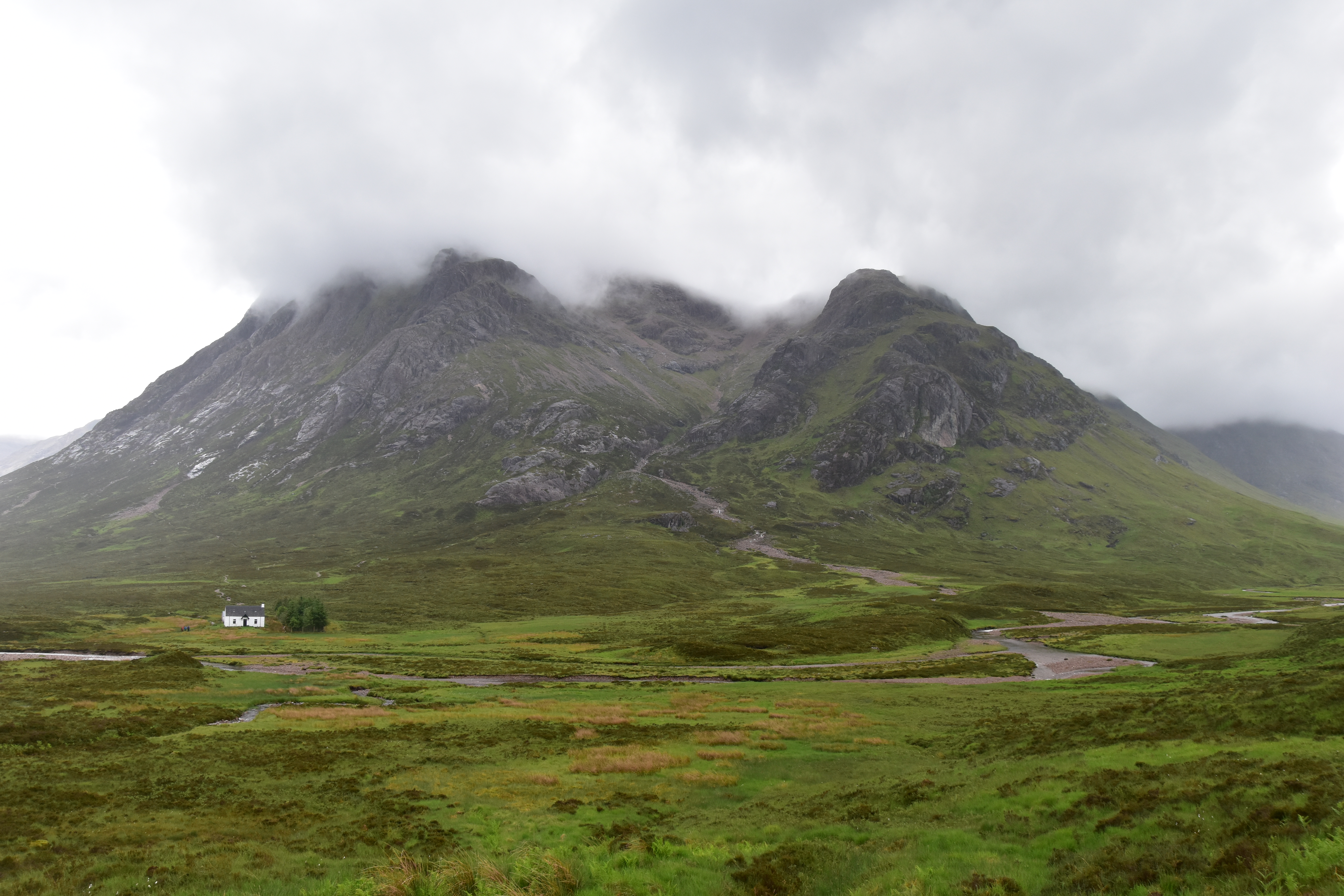
Rannoch Moor, a large moorland plateau strewn with sparkling lochs, suddenly opens. The road is now a wide ribbon of tarmac heading straight across the stunningly rough, untouched nature. The impression of space is undescribable and hardly mitigated by the steep mountain slopes which gently encircle the horizon. My heart starts beating faster and I stare wide-eyed at this wild and remote immensity. Not a building to be seen around, except at the tiny Glencoe Mountain Resort nestled about about a mile off the road to the left. And there “it” appears…
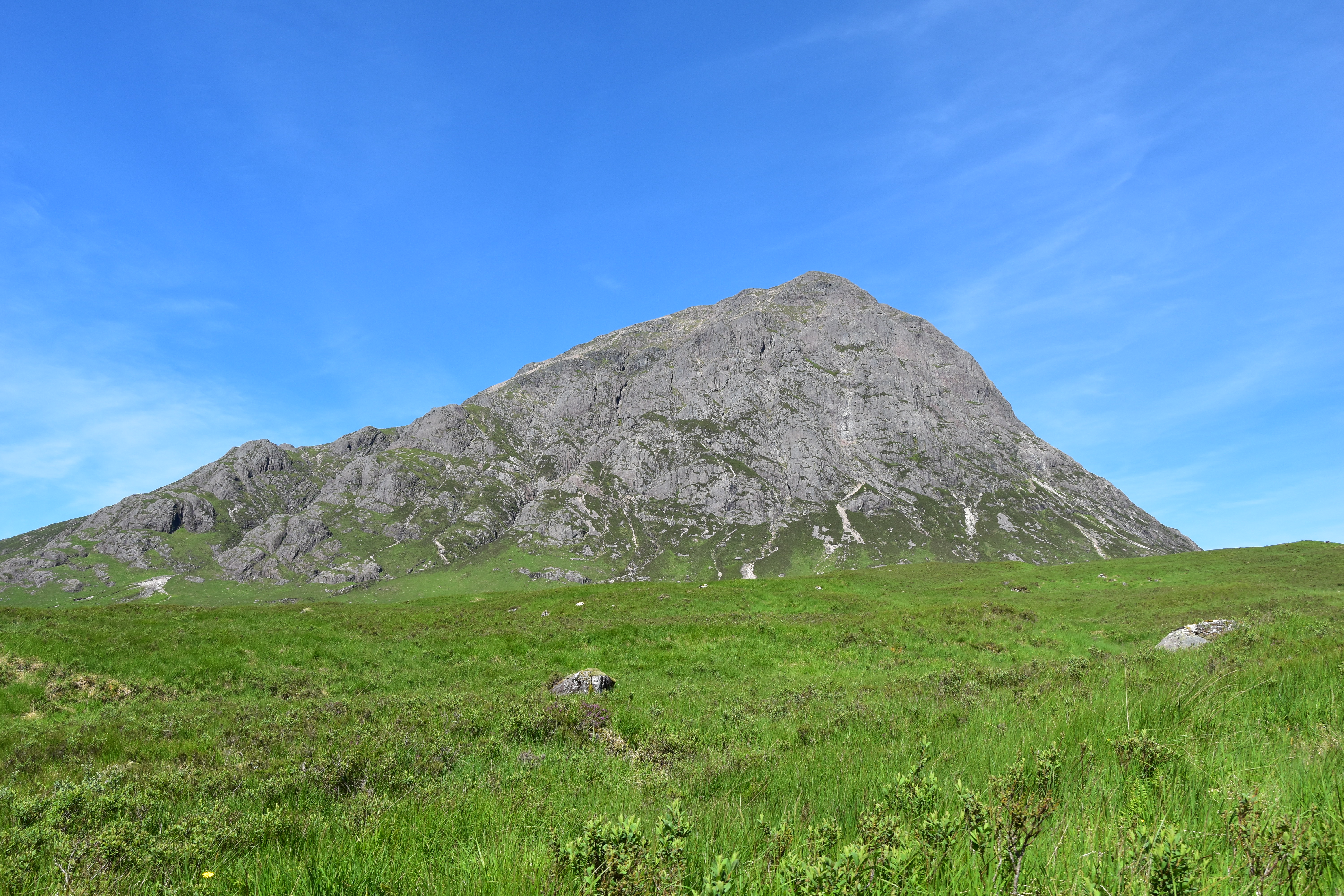
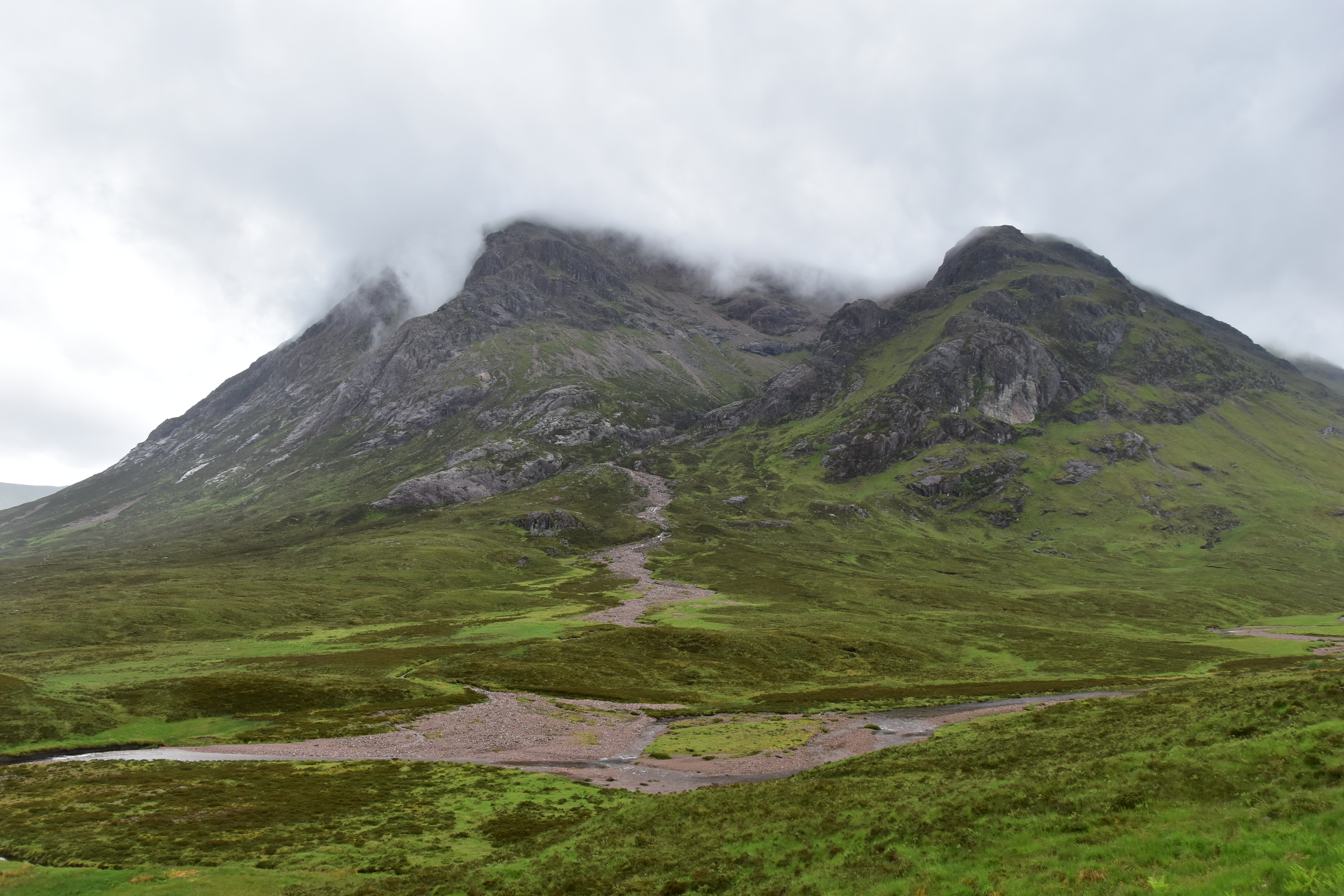
Buachaille Etive Mor, “The Big Herdsman of Etive”, Scotland most photographed mountain, and one of the most iconic too, stands at the meeting of two valleys: Glencoe, where the A82 winds its way to the NW between two dramatic ridges down to the fjord-like Loch Leven, and Glen Etive, where a narrow road sneaks SW, ending in a cul-de-sac by Loch Etive, another fjord-like bay. The Buachaille (pronounce something like “bookill”), as the Scottish call it, is actually a 6km-long ridge which stretches along the remote Glen Etive, SW of the A82. Its highest top is Stob Dearg (1021m), which cliffs stand proudly over 750m above River Coupall, which I follow for a few kilometres as I make my way along the A82. Its NE face is a famous spot for scrambling and rock-climbing, while hikers like me will rather tackle it from the N via the trail which heads up Coire na Tulaich. The road now slightly rises to the small gap which separates Glen Etive and Glencoe, which I drive down to the sea level…

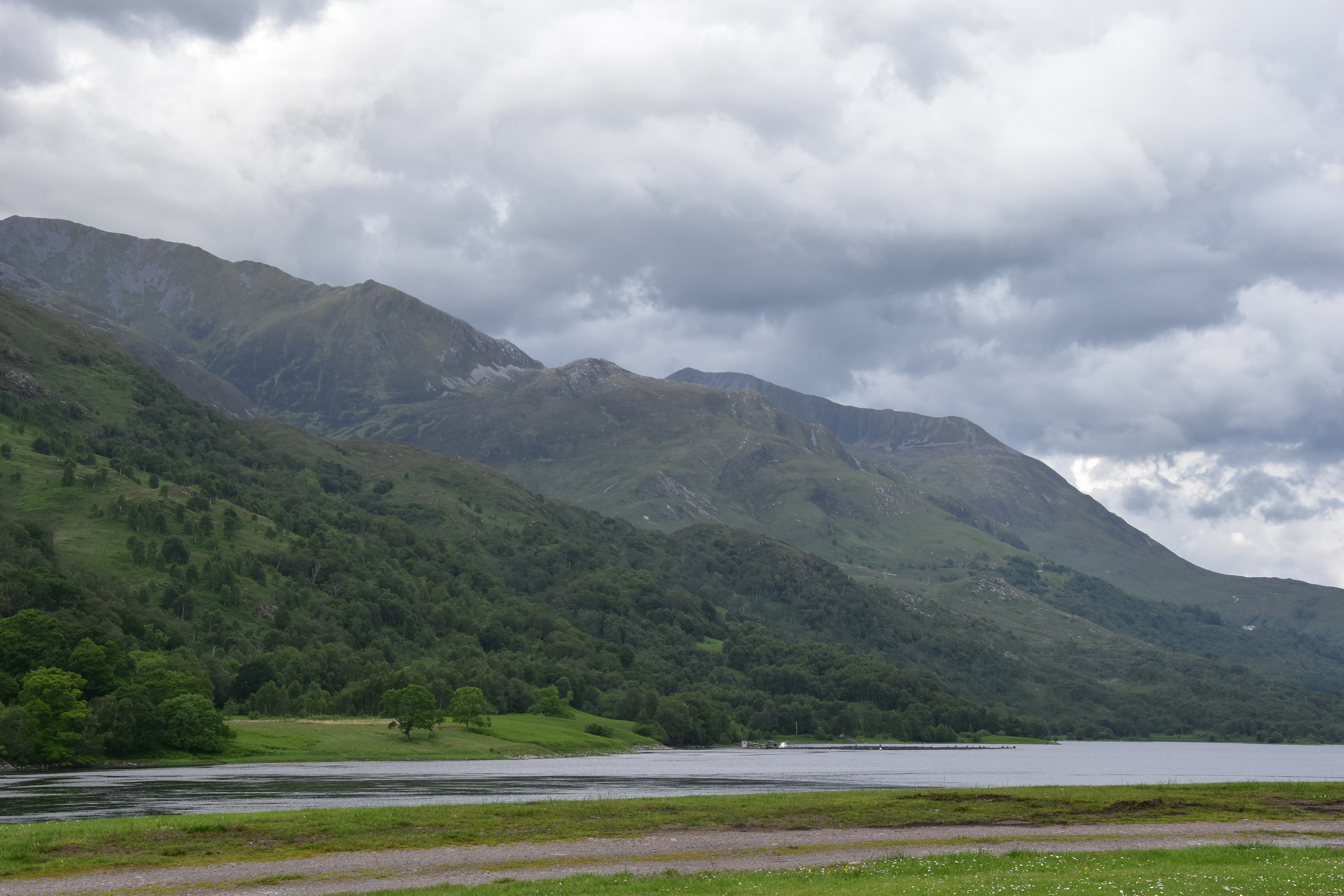
A few hours later, I am sipping a lovely pint of ale in a pub at Kinlochleven. It is about 11pm. I have just settled at the campsite in Caolasnacon, on the banks of Loch Leven. The weather forecast says it will rain in the next few days I am staying, starting from 9/10am the next morning. This means waking up at silly o’clock to hopefully be able to enjoy some dry conditions and some views. Unless…
It is about midnight when I hit the road back to the campsite. Around me, all the surrounding mountains are visible under the clear -though rather cloudy- June skies. I am as excited as an adventurer ready to discover some new territories, ready to conquer the Buachaille. For a peak-bagger like me, there are two munros (see previous article) to bag, plus two minor tops. This would be the best way to start my stay… and my munro-bagging campaign, as the only munro I can claim so far is Ben Nevis (1345m), which I climbed back in 2003. The only problem is, I do not feel tired and will probably not get to sleep until a while. Ideally, I should get up at 4am, which would mean a very short night. But then came the idea, the kind of idea which is both so crazy and brilliant at the same time, it just instantly puts a smile on your face; the kind of idea which just gives you an adrenaline rush and makes your eyes shine bright: and what about going for this hike… RIGHT NOW ?? That means, doing my first night walk, without having a wink of sleep, on a faint path with challenging terrain.
The more I ponder about it, the less reasons I find for not doing it !! The weather conditions ? They should be ok until 9 or 10am. Gear ? I have a head torch plus a spare torch just in case, the GPS and all the rest. The timing ? If I start walking around 2am, I should be up there right on time to watch the sun rise, which is something I have always wanted to do !! I thus sit in the tent and meticulously get my gear ready. It may be almost mid-June and the highpoint hardly over 1000m, warm clothing is mandatory as an addition to the usual waterproof jacket and trousers. And also mandatory is the flask of hot coffee and milk !!

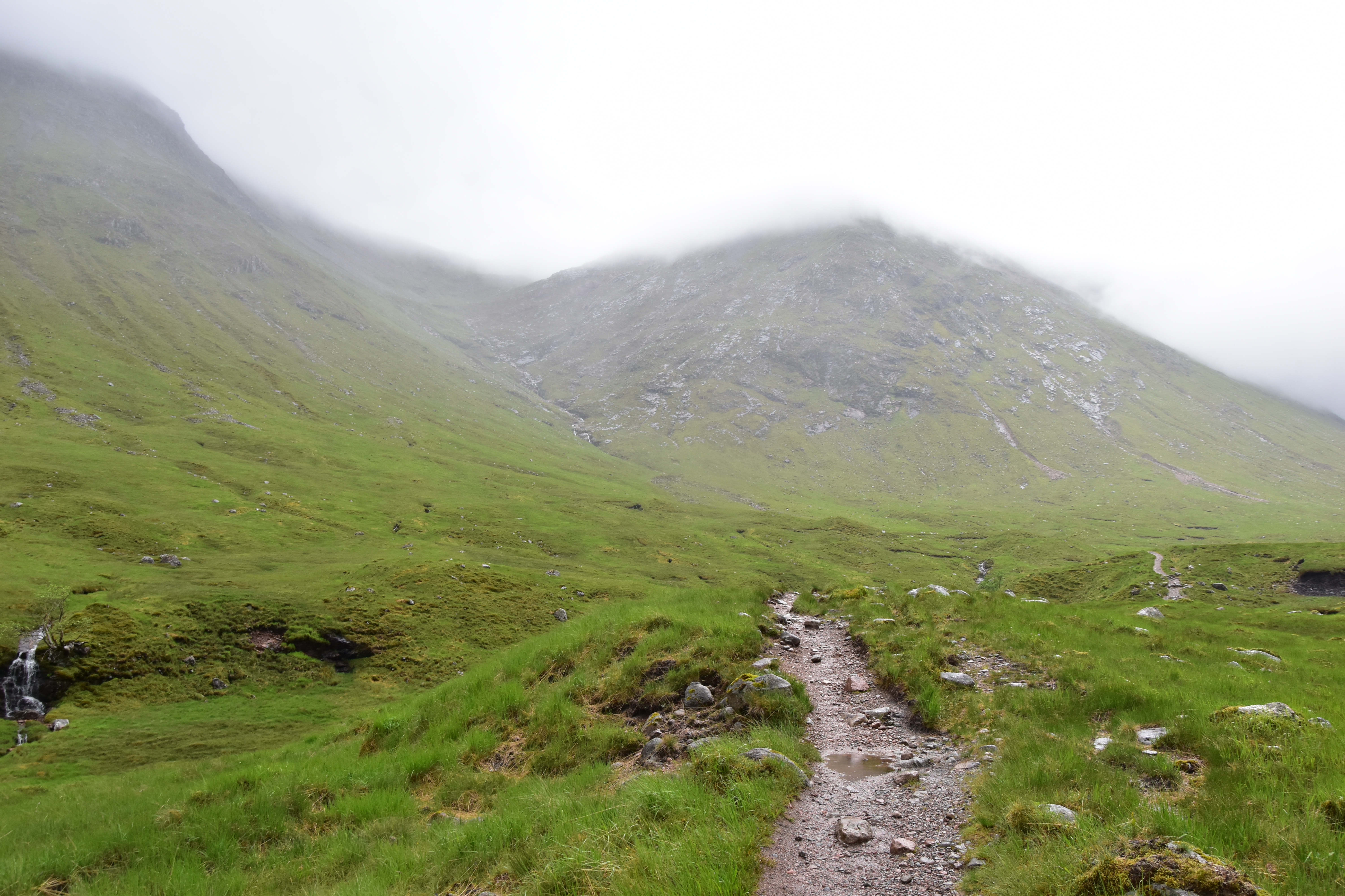
It is a few minutes past 2am when I park along the A82, facing the rocky giant. Its silhouette is clearly visible, alike its neighbours’. I cross the road and silently walk past a campervan parked down beneath the roadside. I feel quiet and concentrated, but I am exulting inside. Here I am on my very own, facing Buachaille Etive Mor, at a time when almost the whole country is asleep. And only after a good half-an-hour walking do I decide to switch on the head torch, in order to have a better idea of where I am setting foot, especially while crossing Allt Coire na Tulaich, the main stream which runs down Coire na Tulaich, a corrie which rises to the NW of Stob Dearg. The single trail which climbs among the rock and scree strewn along the stream is not really obvious. For once, I choose to check my GPS map as to make sure I do not venture too much off route. Having not slept, the tiredness soon shows up and I am watchful as not to unintentionally venture on the steeper ground. The trail appears and disappears as it zig-zags in a never-ending chaos of rocks and boulders to reach a col around the 870m contour. Just below the col, as dawn invites me to turn the head torch off, the wind starts taking in. I am just over with the only little bit of scrambling when a gust of wind makes me falter, reminding me how tiny I am in this dramatic, but rough and unspoiled scenery, and how cautious I will have to remain all along the rest of the walk.

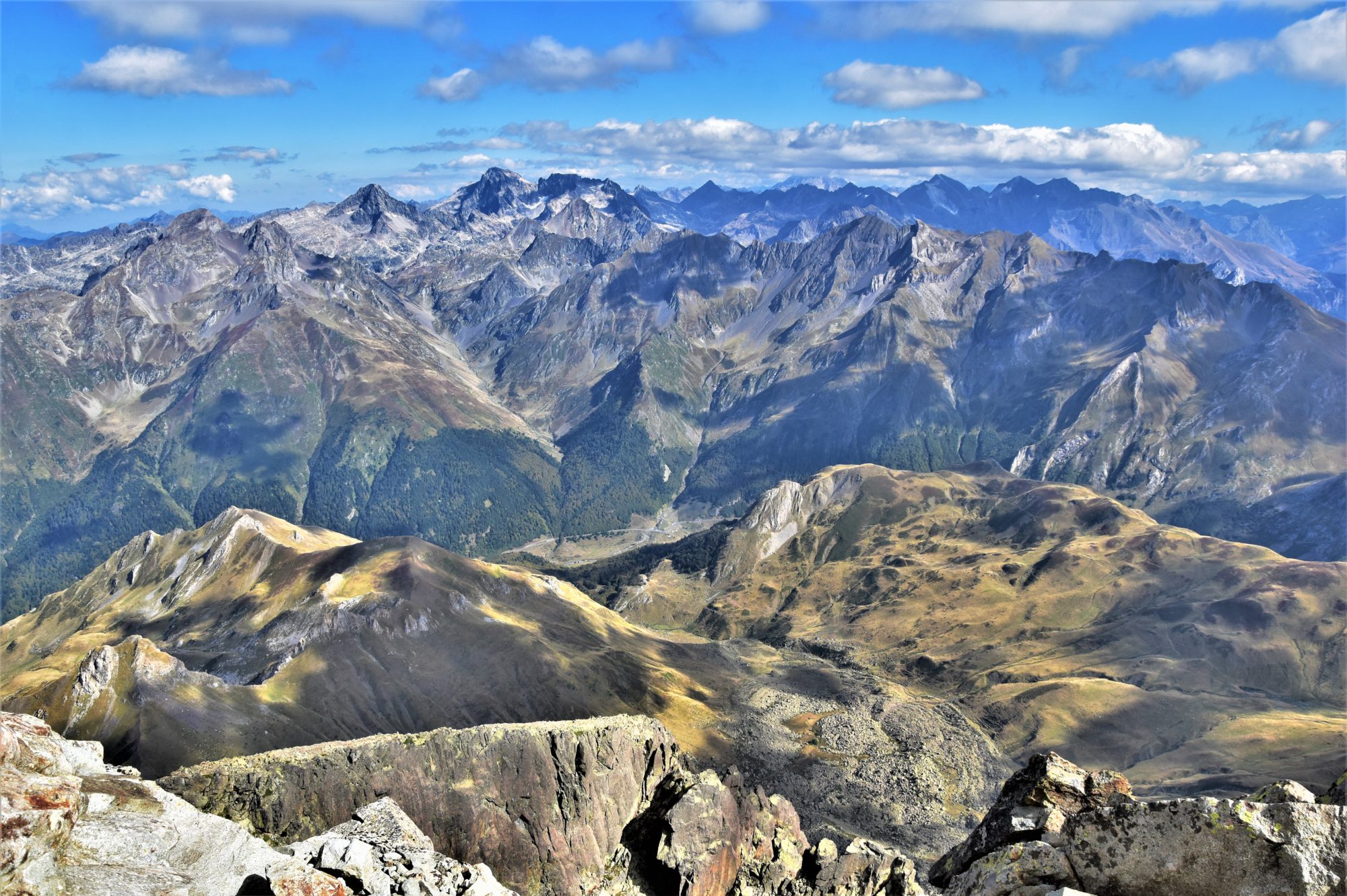
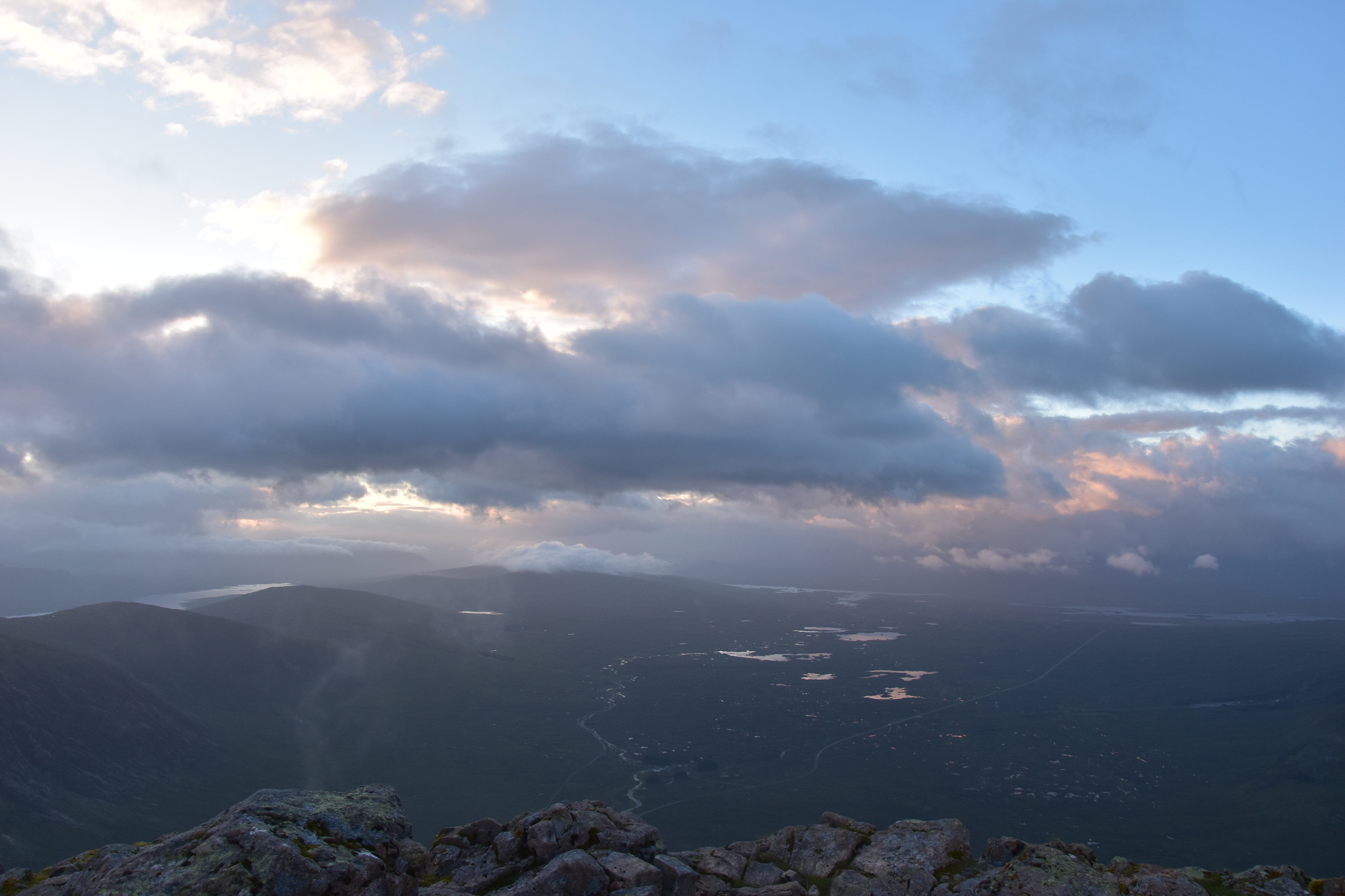
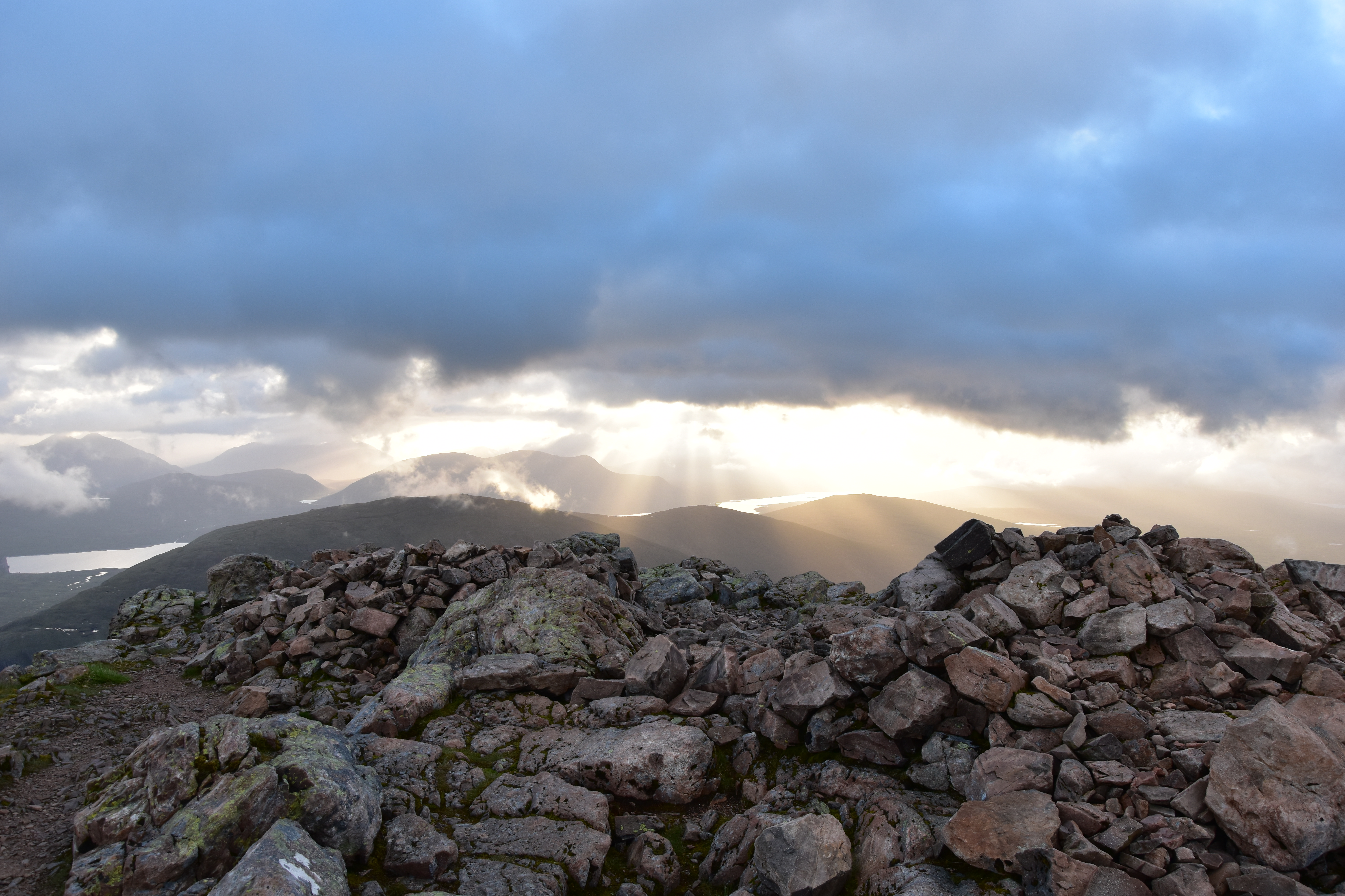
Despite the wind blowing harder, I am relieved to reach the col. The views open to the SE over the cloudy ridge of Creise (1100m), across Glen Etive. The rest of the ascent up Stob Dearg (1021m) should not be too taxing. As I make my way up to the top, the adjective “Dearg”, which means “red” in gaelic, gets meaningful: the rock is pink-red indeed. Clouds pass over the surrounding ridges but seem to ignore Stob Dearg. After about 2h15, I reach the summit, five minutes only before sunrise. Too cloudy to expect a full set of bright colours, but nonetheless, what an amazing feeling !!


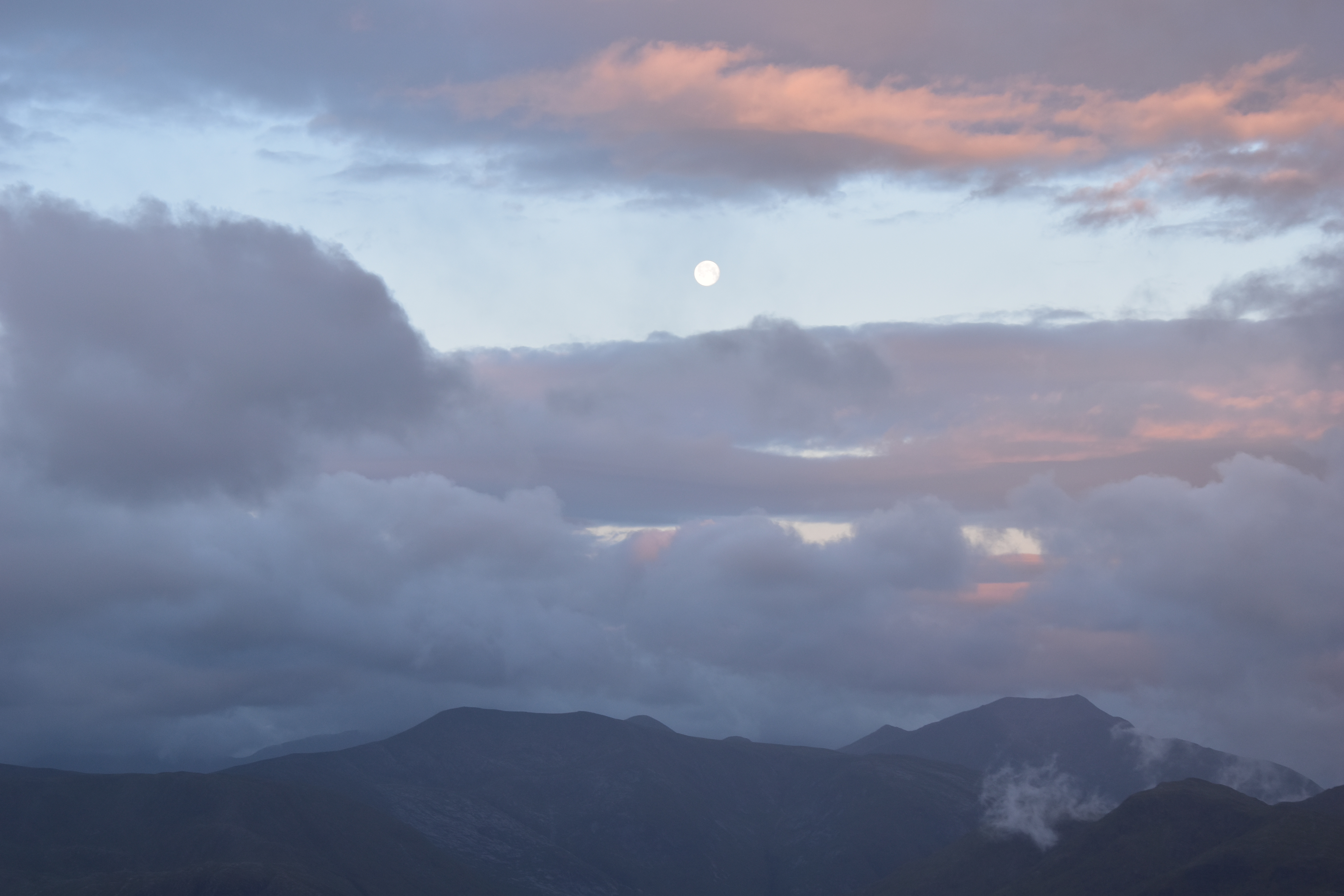

All around me, the numerous, more or less cloudy ridges contrast with the immense flattish stretch of moorland of Rannoch Moor, which I drove through only a few hours ago !! To the NE, the first rays of sunlight struggle to pierce the thick clouds. Behind me, the full moon appears over the faraway ridges, in a patch of blue sky between the clouds. I can feel a shiver running down my spine, and that is not only due to the chilly wind !! I have done it !!

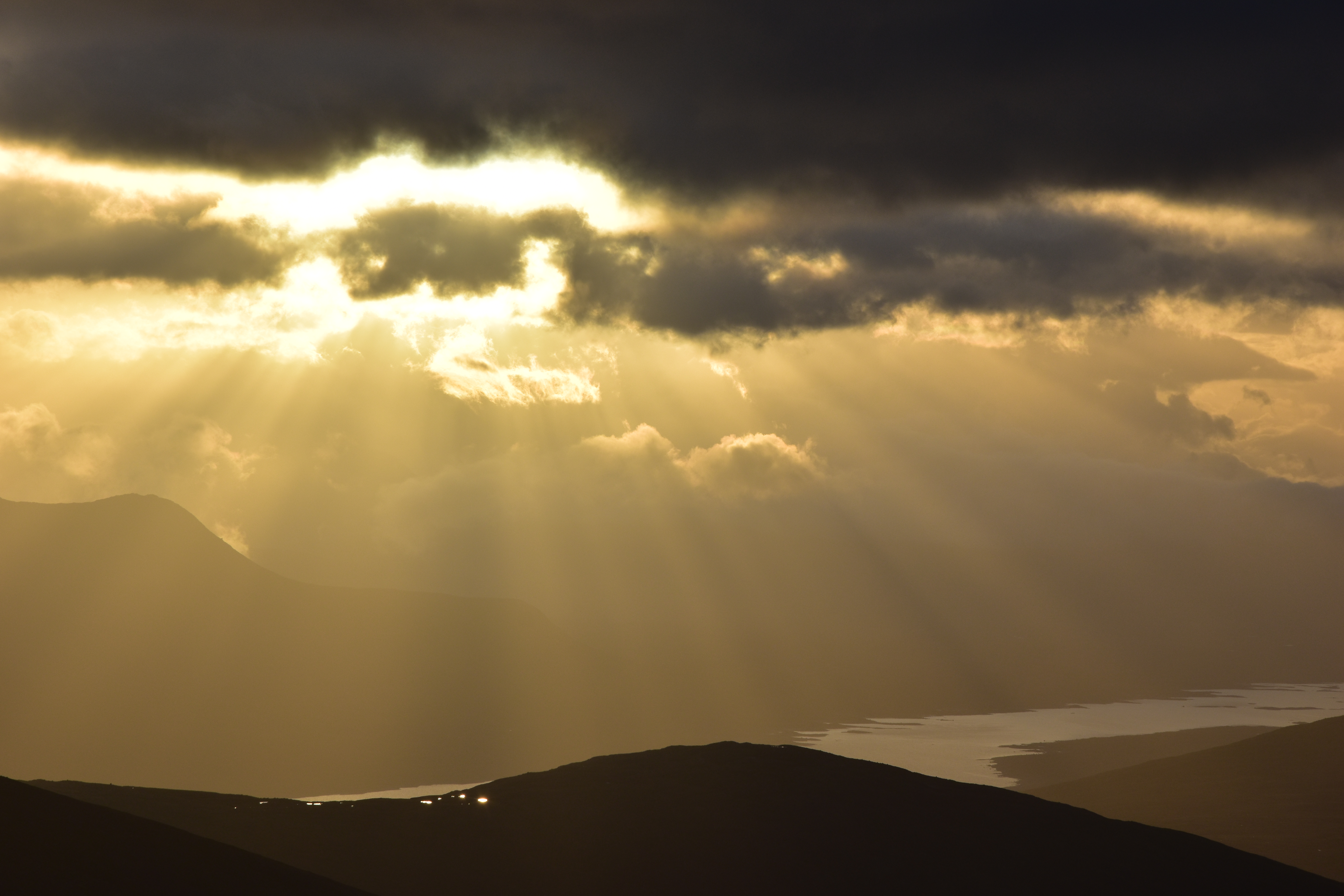
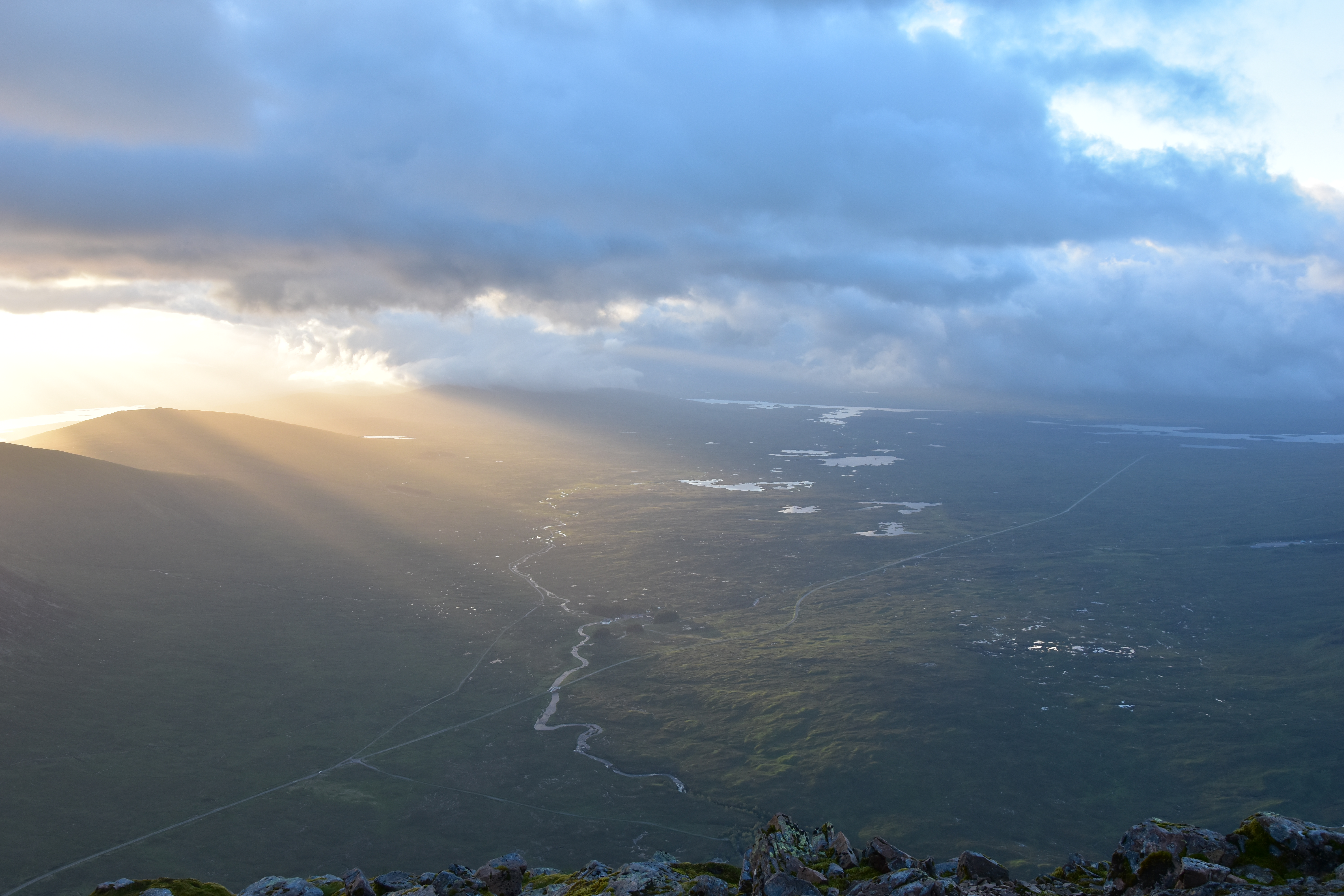
When the sun breaks through the clouds at last, lighting up lochs and mountainsides here and there, I feel totally immersed in this magical scenery. Hidden in the summit shelter, I take dozens of photos as the light comes and goes. The hot coffee is my best ally during this full hour of pure delight, unique, magical moments which will be etched forever in my memory.


Suddenly, the neighbouring ridge of Buachaille Etive Beag (“The Small Herdsman of Etive”) appears in all its glorious colours under the blinding, changing sunlight; only a few minutes later, Rannoch Moor is also bathed in sunlight. Breathtaking !!

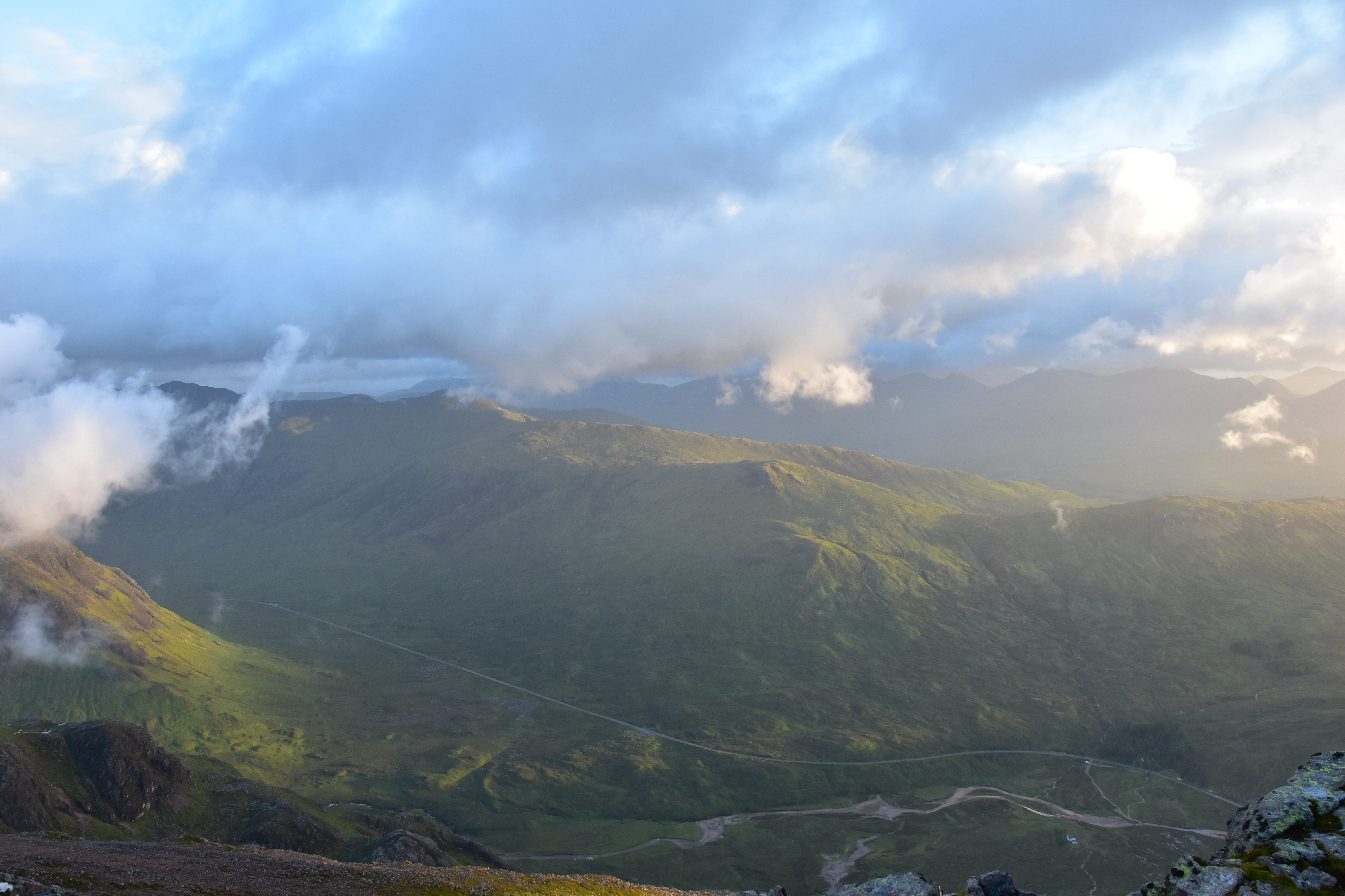


It is around 5.30am when I decide to continue my journey over the ridge. I head back down to the col and make my way up Stob na Doire (1011m). During the ascent, I can enjoy the views over Stob Dearg, before the clouds and drizzle win the race.
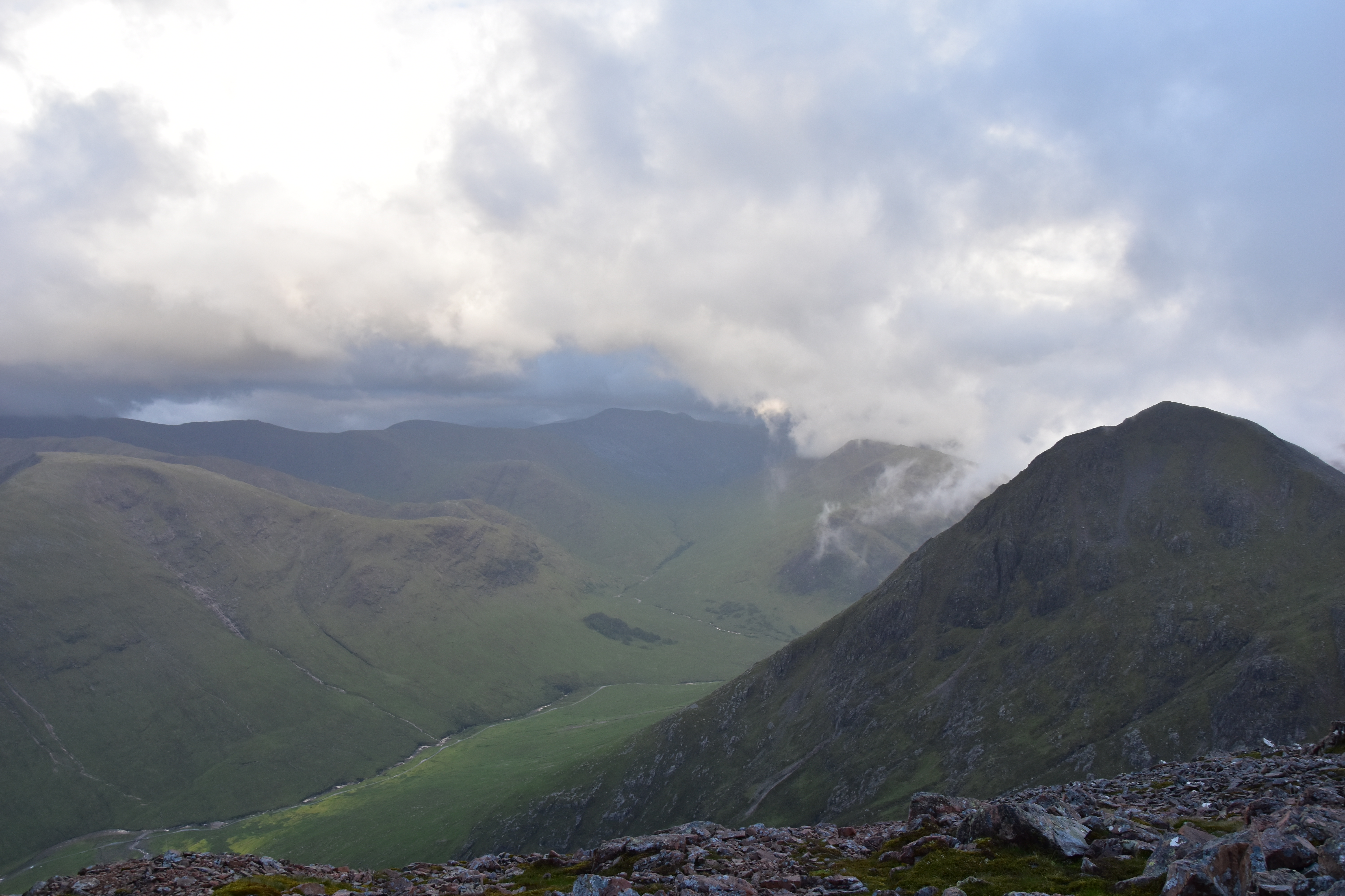


The descent from the top of Stob na Doire is rather steep but not difficult. All along this ridge, the trail is obvious and never really exposed, offering great walking even under the clouds and drizzle. I will have to be back for the views though, especially on the second half of the ridge, which I entirely walk out and back in the mist…


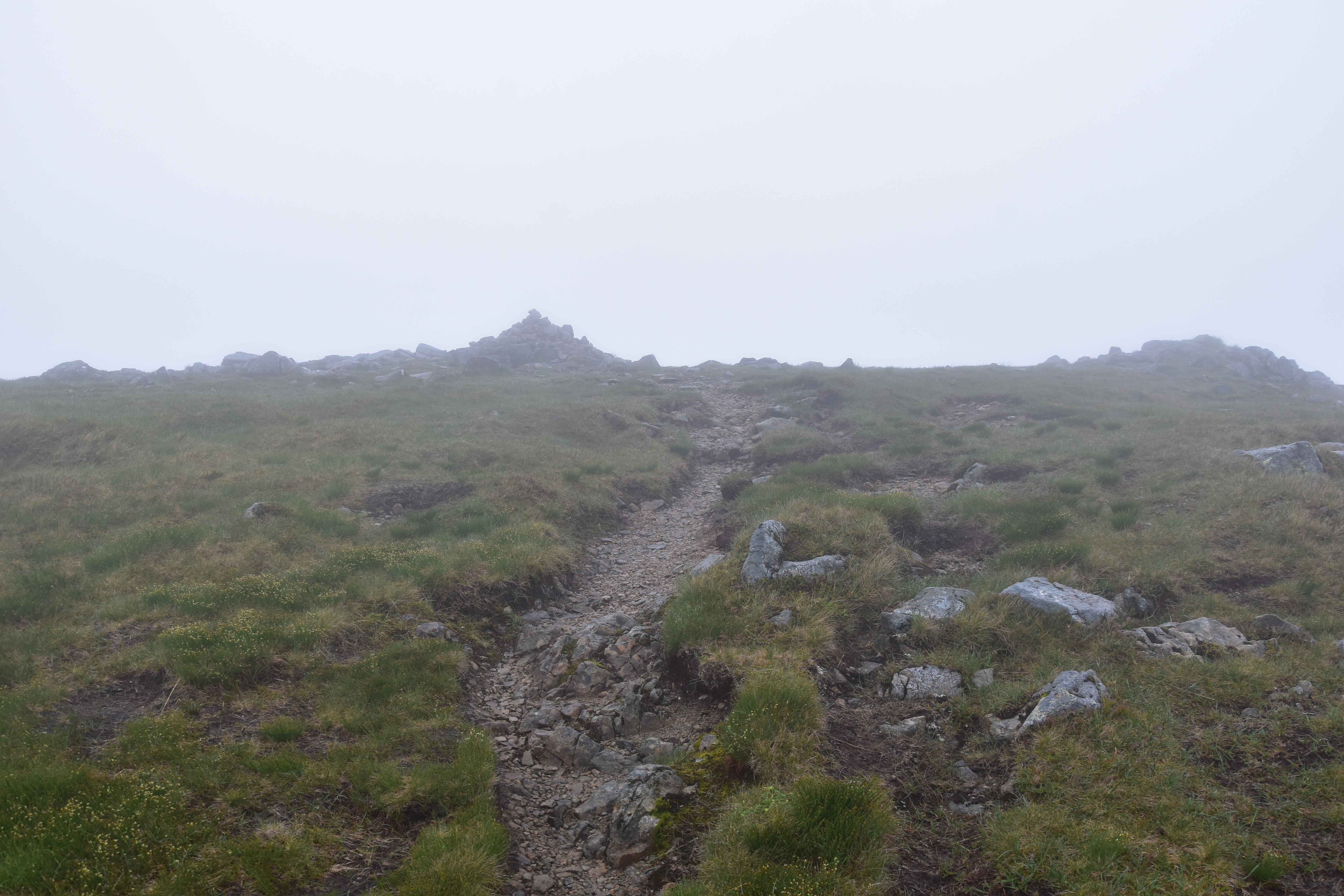


After a quick visit up Stob Coire Altruim (941m) and the second munro of the day, Stob na Broige (956m) between mist and drizzle, I retrace my steps back to the second col, where I head steeply downhill along the well-defined trail which runs down Coire Altruim. Care is required due to the slippery rocks and I am relieved to see the path which runs along Lairig Gartain, between Buachaille Etive Mor and Buachaille Etive Beag. The last difficulty of the day is the crossing of River Coupall, which is fortunately not too wide at this point, and allows you to reach the main path.
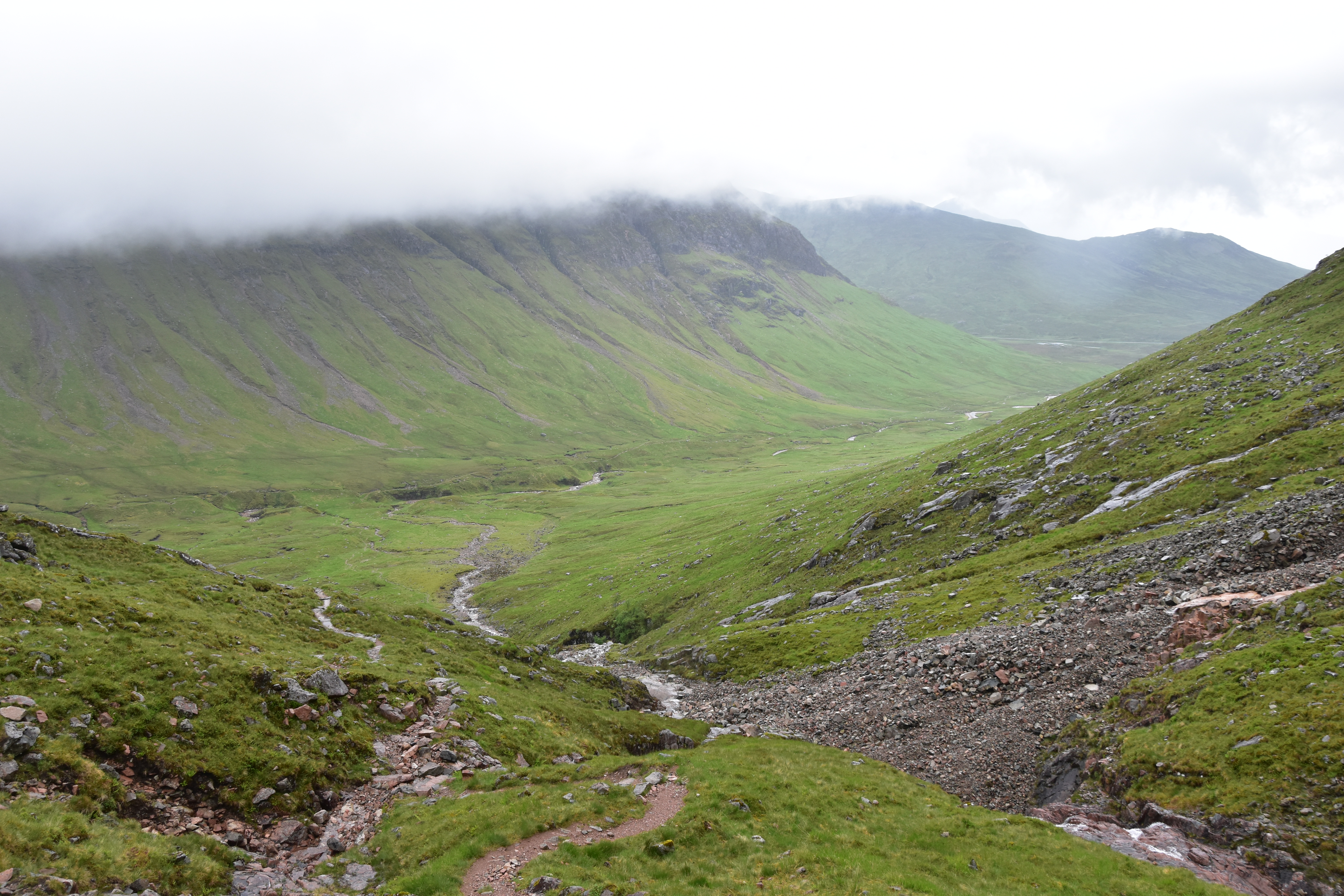


From there, the well-trodden path runs along River Coupall until it reaches the A82 close to my starting point. It is about 9.45am when I reach the car, smiling at other walkers getting ready for a wet day out while I am back, my heart still filled with these unique, unforgettable moments, my eyes shining with emotion as I stand facing the steep crags of the Big Herdsman of Etive, my head in the clouds just like the mountains around me…

Distance: ca. 16.5km; total ascent: about 1100m; duration: 7h30, including about 1h00 on the top of Stob Dearg.
Difficulties: The ascent is mostly made on rock and the use of hands is required at one point below the col, but nothing really technical. No big difficulty on this walk terrain-wise… under good weather !! One never gets a feeling of exposure along this magnificent ridge walk, but beware of the wind nonetheless !! And care required on the wet rocks, especially on the way down. Also, navigation could be an issue on the way up as one loses the faint trail easily. Once on the ridge, it becomes all the more easy, as there is only one obvious trail.
I fully agree with the above comment: What a way to climb this iconic mountain!
I have spent quite a few nights on mountains in my tent but have never done an actual hillwalk at night – something I should try sometime!
Brilliant photos, and a wonderful description of these magical moments at sunrise. Many thanks and well done 🙂
Thank you very much for your kind comment, hearing such compliments from a munroist who has several TGO challenges under her belt makes it all the more meaningful to me !! All the best for 2018 !! 😀
Absolutely fantastic. What a genius idea to just go early and June is probably the best time of the year for sunrise. Stunning photos. What an amazing experience. I’m sure you’re really glad you went early.
Sorry for replying so late, thank you very much for reading and commenting, yes it was a brilliant experience and I will surely do it again !! I should be back to Scotland next June hopefully !! 🙂