Plan de Montmajou – Sommet de Prat-Pardin, out and back along the ridge which marks the border with Spain, from the village of Artigue.
Route details and GPX track:
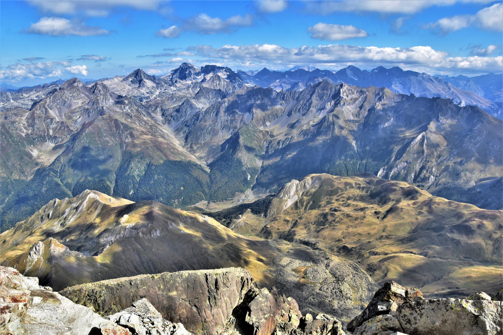
A gentle ascent via the GR10 from Artigue (mandatory car park just before the entrance of the village) to the foot of the Plan de Montmajou (2081m), via the Cabane de Saunères, then straight up to the top; next I followed the ridge which marks the boundary between Spain and France in a southbound direction, to the Sommet de Prat Pardin (1982m) via two minor tops. Return along the ridge and along the SW slopes of the Plan de Montmajou to rejoin the GR10.
Muckish as seen from the N56 between Dunfanaghy and Creeslough.
From now on I will put forward a new topic: taking you up Ireland’s iconic mountains. Those which can be seen from far away, those which steep slopes make your eyes open wide, which summit vista is as beautiful as a dream, yet which name sometimes sends shivers down your spine while thinking of their huge size and how hostile they can be under bad weather. The changeable, unpredictable weather conditions combined with the usually hard-going terrain indeed turn these hills into mountains. Despite their modest height and the rather reasonable amount of ascent implied, the Irish mountains are tough for the novice. But when it clears out, even just a bit, it is pure magic…
Saturday, 9. June 2017, Scotland at last !! Heading N on the A82 along Loch Lomond, the second largest lake in Great Britain after Loch Ness, I am becoming impatient. This portion of the road is winding and not too wide, but busy, not leaving many opportunities to enjoy the magnificent scenery. After the loch, it widens and heads straight N up the valley. Crianlarich, Tyndrum, Bridge of Orchy. Between these touristic villages, a void. Or should I say, beautiful, green landscapes, overlooked by the steep slopes of a few invisible munros.Then the road follows the edge of Loch Tulla before veering up the large hairpin, taking the stranger into another dimension…
The A82 crossing Rannoch Moor at sunset. Left in the distance stands Buachaille Etive Mor.
Rannoch Moor, a large moorland plateau strewn with sparkling lochs, suddenly opens. The road is now a wide ribbon of tarmac heading straight across the stunningly rough, untouched nature. The impression of space is undescribable and hardly mitigated by the steep mountain slopes which gently encircle the horizon. My heart starts beating faster and I stare wide-eyed at this wild and remote immensity. Not a building to be seen around, except at the tiny Glencoe Mountain Resort nestled about about a mile off the road to the left. And there “it” appears…
My second article will take you to the heart of the Mourne Mountains in Northern Ireland, about one hour driving distance S of Belfast. After so many trips on the Emerald Isle, it was about time for me to visit this popular area, one of the only main mountain ranges I had not yet set foot on. In my quest of climbing all of the Irish +500m summits, I had only visited two in Northern Ireland, Slieve Croob (539m) and Slieve Gullion (574m), respectively N and WSW of the Mournes. A few days’ trip last November would allow me to add a few others to my personal list…
A CHOICE OF ROUTES UNDER BEAUTIFUL NOVEMBER SKIES…
But why November ? Not the best period for hill-walking, usually wet, dull and cold and the days are short. But I have been in Ireland every year in November since 2012 and the weather has not always been that bad. The only thing is, you need an early start if you intend to complete long walks or you will have a night finish.
The Mournes are definitely the ideal place for a peak-bagger like me. The summits are relatively close to each other and most of them can be accessed with good trails -which is rather unusual in Ireland. If the weather allows, I could bag quite a few of the 35 +500m listed summits during these four days. And there is a great choice in linear routes or loops. Therefore, I will decide of my first route only on the previous night…
Thick clouds rolling over the summit of Slieve Muck…
For my first article, I will take you for a walk in the East-Central Pyrenees, back to a (short) time when I was just thinking about doing my own thing. At the time, I could only go walking on week-ends or holidays, as I was spending the week working in an office -but that was before I started this blog…
Looking at the Mont Garias (2006m) from the beginning of the walk, along the GR10.